
Seminars
Summer 2026 AOES Seminars
9 Jun (CLIM) Williams, MS Defense – Heterogeneous Land Cover
Jaedyn Williams, GMU Climate Science MS Program
Modeling the Intricacies of Climate Feedbacks on Homogeneous versus Heterogeneous Land Covers
Tue, 9 Jun, 3:30pm, Exploratory Hall L003
Advisor: Paul Dirmeyer
Graduate Symposium
2026 Earth System Observations and Modeling Graduate Symposium, April 10th. Accepting Abstracts.

Spring 2026 AOES Seminars
21 Jan (CLIM) Ruess, Virginia Climate
P Ruess, George Mason U
The Virginia Climate Assessment
Wed, 29 Jan, 1:30pm Innovation Hall 131 and via Zoom (for link, email bklinger@gmu.edu)
22 Jan (GEOL) Anya Hess, Paleoceanography
Speaker: Anya Hess, George Mason University
Time: Thu, 22 Jan, 4:30pm ET
Location: Exploratory 1309 and via Zoom (for link, email lhinnov@gmu.edu)
Title: Ocean Oxygenation Response to Climate Change: Lessons from Past Warm Periods
Abstract: In recent decades, the oceans have lost oxygen at an alarming rate, yet climate model projections for the future of this trend diverge beyond the year 2100. Reconstructions from the geologic past, particularly past warm periods, can help us anticipate the long-term response of ocean oxygenation to climatic warming. I will discuss how and why oxygenation responded to two past warm periods, the Pliocene (~3 Ma) and Miocene (~16 Ma), that are analogous to our not-too-distant future under different emissions scenarios. Ultimately, we will see what lessons the past can teach us about the future of ocean (de)oxygenation.
Bio: Anya is a Postdoctoral Research Fellow at George Mason University, using geochemical tools to reconstruct ocean oxygenation response to past climate change.
29 Jan (GEOL) Jood Al Aswad, Paleobiology
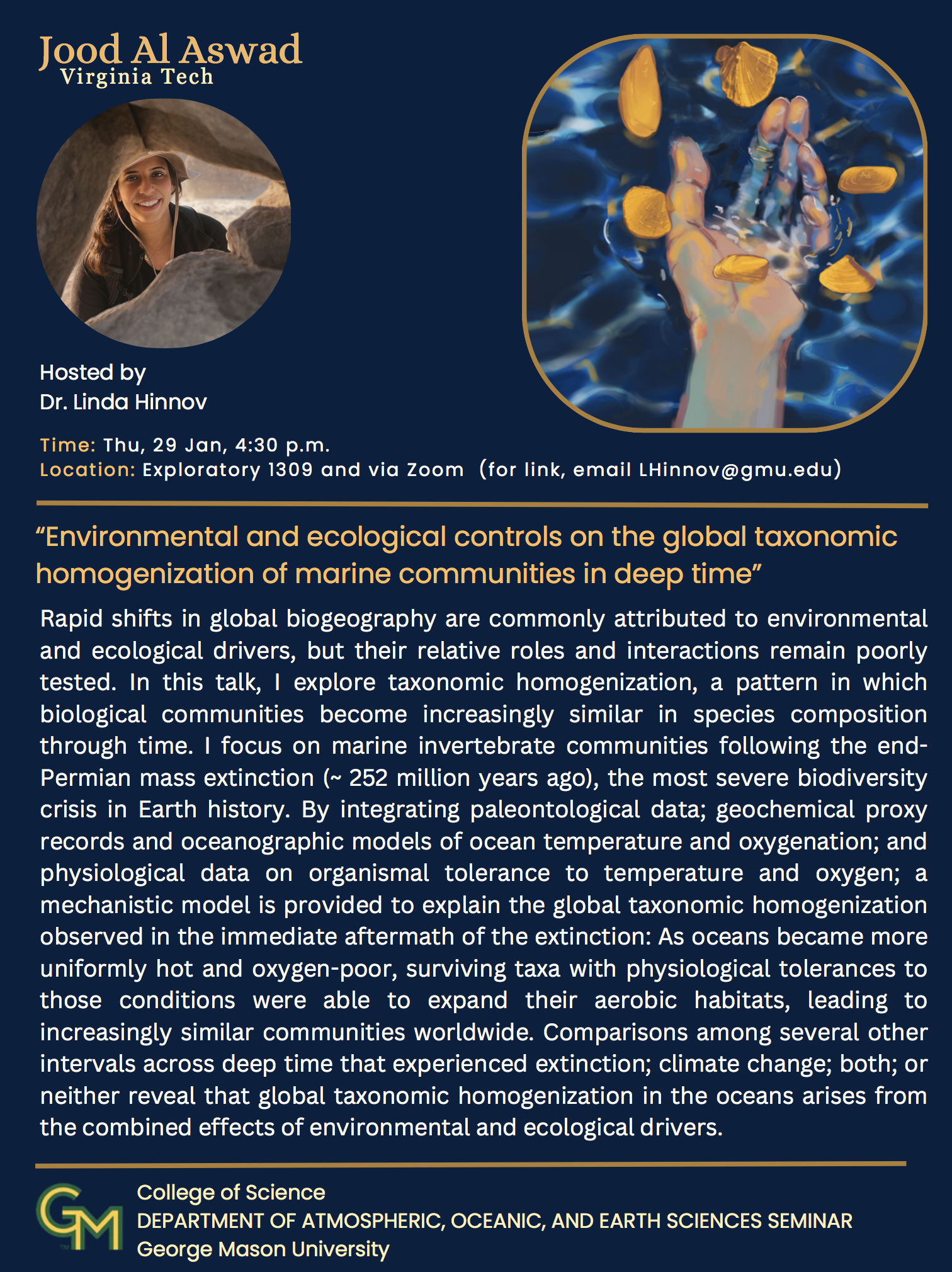
Speaker: Jood Al Aswad, Virginia Tech
Time: Thu, 29 Jan, 4:30pm ET
Location: Exploratory 1309 and via Zoom (for link, email lhinnov@gmu.edu)
Title: Environmental and ecological controls on the global taxonomic homogenization of marine communities in deep time
Abstract: Rapid shifts in global biogeography are commonly attributed to environmental and ecological drivers, but their relative roles and interactions remain poorly tested. In this talk, I explore taxonomic homogenization, a pattern in which biological communities become increasingly similar in species composition through time. I focus on marine invertebrate communities following the end- Permian mass extinction (~ 252 million years ago), the most severe biodiversity crisis in Earth history. By integrating paleontological data; geochemical proxy records and oceanographic models of ocean temperature and oxygenation; and physiological data on organismal tolerance to temperature and oxygen; a mechanistic model is provided to explain the global taxonomic homogenization observed in the immediate aftermath of the extinction: As oceans became more uniformly hot and oxygen-poor, surviving taxa with physiological tolerances to those conditions were able to expand their aerobic habitats, leading to increasingly similar communities worldwide. Comparisons among several other intervals across deep time that experienced extinction; climate change; both; or neither reveal that global taxonomic homogenization in the oceans arises from the combined effects of environmental and ecological drivers.
Bio: Jood Al Aswad is a quantitative paleobiologist, and her research integrates paleobiology with information from oceanography, animal physiology, geochemistry, and stratigraphy to examine how ancient and modern marine invertebrate ecosystems respond to environmental change. She began her academic journey right here at George Mason University, where she earned a BS in Earth Science before attaining an MS in Geological Sciences from Cornell University and a PhD in Geological Sciences from Stanford University. Currently, she is a postdoctoral associate at Virginia Tech.
4 Feb (CLIM) Burls, [Postponed] Moved to Fri 13 Feb
Natalie Burls, George Mason U
Modeling Pliocene warmth, forcing, and climatic characteristics
Wed, 4 Feb, 1:30pm Innovation Hall 131 and via Zoom (for link, email bklinger@gmu.edu) Seminar Postponed - new date/time to follow
See new info for 13 Feb
5 Feb (GEOL) Carolyn Ruppel, Marine Geology
Speaker: Carolyn Ruppel, MIT Energy Initiative
Time: Thu, 5 Feb, 4:30pm ET
Location: Exploratory 1309 and via Zoom (for link, email lhinnov@gmu.edu)
Title: Seafloor Methane Emissions and Gas Hydrate Dynamics on the US Atlantic Margin
Abstract: Nearly 15 years ago, the discovery of widespread seafloor methane emissions from the continental slope (100 – 2000 meters) between Florida and Cape Cod challenged prevailing wisdom about fluid flow and gas hydrate dynamics on this ancient, tectonically-inactive passive margin. The methane seeps, which are especially prevalent offshore Virginia to New Jersey, act as relief valves for the seafloor gas system and are critical for mobilizing carbon from the geosphere to the hydrosphere and sustaining seafloor chemosynthetic communities and water column ecosystems. Geophysical, geochemical, and seafloor video data and geochronologic analyses have revealed clues about the longevity of seafloor emissions within particular seep fields, the factors controlling seep distribution as a function of both depth and position along the margin, and the degree of connectivity between seafloor emissions and the gas hydrate reservoir. This talk will explore key findings related to seafloor methane emissions on the U.S. Atlantic seaboard within the broader context of gas hydrate distribution, methane migration through seafloor conduits on multiple timescales, and the potential for future changes in emissions as intermediate ocean waters continue to warm.
Bio: Carolyn Ruppel is the Deputy Director of the MIT Energy Initiative, an industry consortium focused on the clean energy transition. She is also an emerita ST-rank senior research geophysicist at the U.S. Geological Survey, where she worked from 2006 to 2025. Carolyn led the USGS Gas Hydrates Project for 15 years and served as the Acting Sr. Science Advisor to the USGS Chief Scientist starting in July 2022. Carolyn received all her degrees from MIT, did a postdoc at Woods Hole Oceanographic Institution, and was then a geophysics professor at Georgia Tech (1994-2006) and a program officer at the National Science Foundation (2003-2006). She is a fellow of the Geological Society of America and a recipient of the Distinguished Service Award, the highest honor of the U.S. Department of Interior.
11 Feb (CLIM) Golhke, Floods, Heat and Health
Speaker: Julia Golhke, Virginia Tech
Title: Floods, Heat, and Health: Climate change risks and adaptation strategies across urban and rural environments
Time: Wed, 11 Feb, 1:30pm
Location: Innovation Hall 131 and via Zoom (for link, email bklinger@gmu.edu)
Host: Daniel Tong
Dr. Julia Gohlke is a Professor in the Department of Population Health Sciences at Virginia Tech in Blacksburg, VA. Her research group is currently employing spatial epidemiology methods to examine health outcomes associated with resource extraction, and heat and flood events across urban and rural landscapes. She collaborates with earth scientists, environmental engineers, geographers, computer scientists, and statisticians to understand how climate change, and mitigation and adaptation strategies, influence human health outcomes. One example she will discuss utilizes satellite-derived estimates of inundation extents to categorize flood exposure and subsequently evaluate changes in emergency department visits following flood events. Another example she will present uses estimates of sea level rise to assess changes in mortality risk due to coastal flooding. She currently teaches graduate level courses in rural environmental health and Appalachian community research and directs an NIH-funded PhD training program in rural environmental health.
12 Feb (GEOL) Allen Gellis, Geomorphology
Speaker: Allen Gellis, Department of AOES, George Mason University
Time: Thu, 12 Feb, 4:30pm ET
Location: Exploratory 1309 and via Zoom (for link, email lhinnov@gmu.edu)
Title: Sediment Fingerprinting: Provenance in a Watershed Context
Host: Linda Hinnov
Abstract: Sediment provenance, in the geologic sense, commonly refers to the source rocks and tectonic setting from which sediment was derived, as well as the pathways it followed before being deposited in a sedimentary basin. Sediment fingerprinting is related, but focuses on identifying modern sources of fluvial sediment, typically the silt and clay fraction (<63µm), within a watershed context.
Sediment fingerprinting is based on characterizing the geochemical properties of potential upstream “sources” and comparing them to "target" sediment collected at a downstream delivery point. By using statistical mixing models, the relative contributions of different land uses or geomorphic sources can be determined.
Because sediment is a major pollutant worldwide — degrading aquatic ecosystems, contaminating water supplies, reducing recreational opportunities, and impairing navigation channels — determining its sources is imperative for developing effective and targeted management strategies to mitigate sediment inputs. Consequently, sediment fingerprinting represents an effective approach to assist land managers in this endeavor. This talk will focus on the methods used in sediment fingerprinting, selected case studies, management implications, and future research needs.
Bio: Allen Gellis is currently an adjunct professor at George Mason University. Before this, he was a Research Geomorphologist with the U.S. Geological Survey, where he was stationed in San Juan, Puerto Rico; Albuquerque, New Mexico; Baltimore, Maryland; and Reston, Virginia. Allen received his Ph.D. and M.S. degrees in Geology from Colorado State University and his B.S. in Geology from SUNY Albany. He is a Fellow of the Geological Society of America. His research has focused on a variety of geomorphic topics, including sediment fingerprinting, sediment budgets, arroyos, sediment yields to Chesapeake Bay, and stream restoration.
13 Feb (CLIM) Burls, Modeling Pliocene Warmth
New day! New Time! Same Room!
Natalie Burls, George Mason U
Modeling Pliocene warmth, forcing, and climatic characteristics
Fri, 13 Feb, 11:00am Innovation Hall 131 and via Zoom (for link, email bklinger@gmu.edu)
18 Feb (CLIM) Simpson, Water Vapor Trends
Isla Simpson, National Center for Atmospheric Research (NCAR)
A global discrepancy in near surface water vapor trends between models and observations
Wed, 18 Feb, 1:30pm Innovation Hall 131 and via Zoom (for link, email bklinger@gmu.edu)
Host: Aahelee Sarker
As the planet warms, it is expected that atmospheric water vapor would rise given the dependence of the atmospheric water vapor holding capacity on temperature. Indeed, in observations over the last four decades, over many parts of the world, this is what has happened. However, over arid and semi-arid regions of the world, near surface atmospheric water vapor has remained fairly constant in the observational record, in stark contrast to the behavior of Earth System Models that are used for long-term climate projections, which suggest water vapor should have risen. This discrepancy represents a significant problem in our models’ ability to represent hydrological processes, or potentially issues with the observational record (or both). If it is a problem with our model representation, then it has major implications for our ability to predict the future of the hydroclimate and associated aspects such as wildfire risk.
19 Feb (GEOL) Rob Domeyko, Paleoclimatology
Speaker: Robert A. Domeyko, Postdoctoral Fellow, University of Texas Institute for Geophysics
Time: Thu, 19 Feb, 4:30pm ET
Location: Exploratory 1309 and via Zoom (for link, email lhinnov@gmu.edu)
Title: Rare coral archives confirm weaker El Niño during colder, abrupt climate regimes
Host: Linda Hinnov
Abstract: Extreme El Niño events – the warm phase of the El Niño–Southern Oscillation (ENSO) – have increased in frequency since the late 20th century, raising concern about how ENSO responds to changes in Earth’s climate system. Climate model simulations suggest that El Niño activity weakens during colder climates and intensifies under anthropogenic warming, yet direct geological evidence from past cold climate intervals remains sparse due to the limited availability of suitable paleoarchives. In this talk, I present new oxygen isotope records from fossil corals recovered from Vanuatu that capture key intervals of the last deglaciation. I combine these records with climate model simulations to evaluate changes in ENSO variance and extreme El Niño frequency during cold, abrupt climate events. The coral records constrain total interannual climate variance at ENSO timescales, while a complementary analysis of model output isolates the portion of that variance associated with ENSO across the tropical Pacific. Both the coral data and model results indicate reduced interannual variance and fewer extreme El Niño events between ~12 and 15 thousand years ago, coincident with the Younger Dryas and Heinrich Stadial 1 abrupt climate events. Model simulations further reveal distinct climate regimes, linking weaker ENSO activity during cold deglacial conditions to stronger variance and more frequent extremes in warmer climates, including under CO₂ doubling scenarios. Together, these results place recent El Niño changes in a longer geological context and suggest that anthropogenic forcing fundamentally alters ENSO behavior, amplifying the impacts of extreme El Niño events across the tropical Pacific and beyond.
Bio: Robert A. Domeyko received his Ph.D. in Geological Sciences from The University of Texas at Austin in 2025. His research focuses on past climate variability, particularly El Niño behavior, using coral geochemical records and climate model simulations to understand how large scale climate change influences tropical climate extremes.
25 Feb (CLIM) Buzan, Methane Emission Reductions
Speaker: Jonathan Buzan, Aalborg U and Vrije U Brussels
Title: Rapid Methane Emission Reductions within Stabilized Climate Scenarios
Time: Wed, 25 Feb, 1:30pm
Location: via Zoom (for link, email bklinger@gmu.edu)
Host: Paul Acosta
26 Feb (GEOL) Barbara Balestra, Micropaleontology
Speaker: Dr. Barbara Balestra, American University
Time: Thu, 26 Feb, 4:30pm ET
Location: Exploratory 1309 and via Zoom (for link, email lhinnov@gmu.edu)
Title: Coccolithophores in IODP Exp 401: Insights into Miocene Mediterranean–Atlantic Exchange
Host: Linda Hinnov
Abstract: Coccolithophores are one of the most abundant groups of phytoplankton living in our oceans. They play a major role in marine primary production and the oceanic carbon cycle, and they are significant components of marine sediments. Studies focus on their taxonomy, zonation development, and applied biostratigraphy. Coccolithophore living and fossil records in the ocean and in the deep-sea sediments are used also in paleoceanographic studies. These studies include using extant coccolithophore assemblages as proxies for temperature and environmental change. In the fossil record, changes in the nannofossil assemblages are linked to variations in the physical and chemical properties of the waters such as salinity, turbidity, temperature, nutrient content, etc. In particular, different coccolith taxa are known to be sensitive to specific environmental parameters.
The purpose of this seminar is to explain what these phytoplanktonic organisms are, why they are important and show how the coccolithophore assemblage variation can be used to characterize the dynamics of the different water masses in paleoceanographic studies. Preliminary results from the recent IODP Exp 401 (December 2022 to February 2023) in the West Iberian Margin, Gulf of Cadiz and Alboran Sea will be also presented. These regions are key locations for the investigation of Mediterranean Outflow Water (MOW) through the Gibraltar Gateway and its influence on global circulation and climate from the Miocene up to today.
Bio: Dr. Balestra is a micropaleontologist with research interests in paleoceanography and paleoclimate. She has a PhD in Earth Science from University of Florence, Italy. She is a Senior Professorial Lecturer and Director of Teaching Laboratories in the Department of Environmental Science at American University, and a Research Associate in the Department of Paleobiology, National Museum of Natural History, Smithsonian Institution.
4 Mar (CLIM/GEOL) Jared Nirenberg, Cold Seas in a Warmer Past
Speaker: Dr. Jared Nirenberg, Syracuse University
Time: Wed, 4 Mar, 1:30-2:30 pm ET
Location: 131 Innovation Hall and via Zoom (see above)
Title: Earth’s coldest regions in a past warmer world: High-latitude climate evolution during the Miocene
Hosts: Po Ju Chen, Linda Hinnov
Abstract: The Miocene Epoch (5 to 23 million years ago) was a recent geologic interval when atmospheric greenhouse gas concentrations were similar to end of century projections. In this seminar, I will present novel analyses of deep ocean sediment cores from high-latitude sites to constrain the degree of high-latitude ocean warming as well as the response of polar climate systems, such as ice sheet behavior and terrestrial hydrology, to temperature changes during the Miocene. My work uses molecular biomarkers for proxy reconstructions of ocean surface temperatures and terrestrial precipitation isotopes from sediments recovered from the polar Southern Ocean near East Antarctica as well as the subpolar North Pacific. I will also discuss ongoing work, in collaboration with scientists at GMU, constraining atmospheric dynamics surrounding dramatic Arctic amplification during the Miocene. Together, these studies of polar paleoclimate dynamics during past global warmth have implications for long-term future climate.
Bio: Jared Nirenberg is interested in the climate of Earth's polar regions in the geologic past, about 15 million years ago. To research this, he uses marine sediment cores to analyze biomarkers, which are molecules produced by ancient organisms preserved in these sediments. From these geochemical analyses, Jared is reconstructing polar temperatures in the past when Earth's climate was much warmer than today, as a potential analogue for a future warmer world.
18 Mar (CLIM) Aboagye-Okyere, African Aerosols
Adwoa Aboagye-Okyere, Cornell U
Natural Aerosols as Drivers of Air Quality and Health in Africa
Wed, 18 Mar, 1:30pm via Zoom (for link, email bklinger@gmu.edu)
Host: Daniel Adjei
Aerosol pollution poses serious threats to human health and ecosystems, and natural aerosols such as dust and emissions from wildfires are likely to have changed substantially due to anthropogenic activities. Using the Community Earth System Model version 2, we simulated dust- and open-fire PM2.5 concentrations over Africa for preindustrial, present-day, and future scenarios. Health impacts were assessed using the integrated exposure-response model applied to gridded population and disease-specific mortality data. In the present day, we estimate that desert dust and open fires cause approximately 30,000 and 20,000 annual excess deaths, respectively, in Africa. Dust dominates PM2.5 concentrations at the continental scale, but lower population densities in dust-dominated regions limit its health impacts relative to combustion sources. Since preindustrial times, excess deaths due to dust and open fires have increased substantially. Across past, present, and future climates, natural aerosols account for more than 50% of PM2.5-attributable mortality in Africa, highlighting their importance for air-quality management.
19 Mar (GEOL), The CycloAstro Project
Speaker: Linda Hinnov, Department of AOES, George Mason University
Time: Thu, 19 Mar, 4:30pm ET
Location: Exploratory 1309 and via Zoom (for link, email lhinnov@gmu.edu)
Title: The CycloAstro Project - A Research Collaboration Between Geoscience and Astronomy
Abstract: The CycloAstro Project is a research collaboration between geoscience and astronomy that seeks new fundamental knowledge about solar system and Earth-Moon dynamics. The project focuses on new approaches to modeling these dynamics, and on the analysis of Earth’s cyclostratigraphy, which contains a record of the actual dynamics preserved as paleoclimate signals. The knowledge that has been gained is being used to investigate:
(1) Earth-Moon parameters and solar system planetary orbit dynamics, 0-2.5 Ga
(2) Astronomical forcing of the paleoclimate system, 0-23 Ma
(3) Solar system solutions beyond the ~50 Ma predictability limit imposed by chaos
(4) Solar system dynamics from continental climate rhythms, 200-240 Ma
(5) Close encounters, collisional fragmentation, and tidal evolution in chaotic systems
This talk will present research highlights from the above categories and discuss the significance of the results to geoscience and astronomy.
Bio: Linda A. Hinnov is a Professor of Geology in the Department of AOES. She specializes in the analysis and modeling of geological data relating to Earth’s past climate variations and its drivers. Currently, she coordinates the ongoing multi-university CycloAstro Project, which seeks to acquire new empirical knowledge about Earth-Moon dynamics, solar system evolution and paleoclimate change through analysis and modeling of cyclostratigraphy.
25 Mar (CLIM) Sohl, Climate Without Vegetation
Linda Sohl, Columbia U
Dust in the wind: Climatic effects of aerosol loading on non-vegetated worlds
Wed, 25 Mar, 1:30pm
Innovation Hall 131 and via Zoom (for link, email bklinger@gmu.edu)
Host: Alia Wofford
The possibility that Precambrian climate was much cooler than previously thought has implications for Earth’s ability to enter and recover from Snowball Earth states, and more broadly, for the potential habitability of terrestrial exoplanets. To assess whether a non-vegetated land surface should necessarily lead to a dustier and colder environment, we explored the Ordovician climate circa 450 Ma, prior to the expansion of vascular land plants. Despite an insolation slightly lower than modern, estimates of higher levels of CO2 suggest that this climate would have been warm and ice-free. Using the ROCKE-3D exoplanet GCM, we find the maximum amount of dust-driven cooling to be no more than 2.5˚C, far less than in Liu et al (2020). Our results suggest that aerosol effects depend greatly on specific boundary conditions, such as continental distribution and atmospheric chemistry.
26 Mar (GEOL) Piero Giuffra, Paleobiology
Speaker. Piero Giuffra, Department of AOES, George Mason University
Time: Thu, 26 Mar, 4:30pm ET
Location: Exploratory 1309 and via Zoom (for link, email lhinnov@gmu.edu )
Title: Back to the Ocean Part II: Evolution of Ecospace Occupancy by Cenozoic Marine Tetrapods
Abstract. The origin of biodiversity is a broad field that can be studied from a multitude of analytical perspectives. Macroevolutionary studies in secondarily aquatic tetrapods (SATs) tend to favour taxic diversity and not enough attention is paid to ecological disparity, which is essential to formulate integral conclusions. Here, we use non-metric multidimensional scaling (NMDS) and principal coordinate analyses (PCOa) to build an ecospace of marine tetrapods during the Cenozoic. We identify four main phases of ecospace evolution that illustrate how Cenozoic marine tetrapods recovered following the K/Pg mass-extinction event. Pulses of diversification reflect a bottom-up recovery following a positive feedback model and show how marine tetrapods adapted to changes in ocean systems and gave rise to the modern assemblage. The interpretation of these phases indicates that ecological diversity increased over time in a discrete incremental progression of disparity punctuated by stasis. Evaluation of macroevolutionary trends in the light of important events in geobiological history within the palaeontological record points to a composite of biotic and abiotic factors driving evolution, instead of one major catalyst being responsible for diversity.
Bio. Piero is a Peruvian PhD student at George Mason University working on the evolution of whales. He received a BA in Geography from the Pontificia Universidad Catolica del Peru and a Master’s degree in Paleobiology from the University of Bristol, UK. He has done fieldwork in the Peruvian Piscio Basin recovering and prospecting for marine mammal remains. This presentation is from his work at Bristol under Professor Mike Benton and is in the process of being published.
1 Apr (CLIM) Booth, Extratropical Cyclones & Heatwave
Jimmy Booth, The City College of New York (CCNY)
What do Extratropical Cyclones have to do with heatwaves in NYC?
Wed, 1 Apr, 1:30pm
Innovation Hall 131 and via Zoom (for link, email bklinger@gmu.edu)
Host: Austin Reed
This talk will cover the physics of extratropical cyclones and the hazards they generate in the Northeast US. First, I will discuss two idealized numerical modeling studies, one focused on a single storm in a weather model and another that examines the time-averaged behavior of extratropical cyclone tracks in an aquaplanet global climate model. Second, I will discuss connections between extratropical cyclone tracks and hazards such as coastal flooding and extreme rainfall. Third, I will talk about if and how ETCs relates to heatwaves in NYC.
2 Apr (GEOL) Arlo Weil, Structural Geology
Speaker: Arlo Brandon Weil, Bryn Mawr College
Time: Thu, 02 Apr, 4:30pm ET
Location: Exploratory 1309 and via Zoom (for link, email lhinnov@gmu.edu)
Title: Multidata-set approach to understanding the kinematics of complex orogenic systems: Insights from the North American Cordillera
Abstract: Quantifying the kinematic evolution of an orogenic system, recorded in its 3-D displacement field, across a range of spatial and temporal scales is challenging, yet crucial for quantifying crustal shortening budgets, determining origins of mountain belt curvature, restoring paleostress-strain trajectories, and understanding relations of orogenesis to plate dynamics. This talk will integrate structural geology, paleomagnetic, and geochronology datasets to reconstruct the tectonic histories of two major belts in the North American Cordillera: the Sevier fold-thrust belt and the Laramide foreland belt.
Together, these belts record a complete orogenic cycle from initial crustal shortening to eventual extensional collapse and offer a natural laboratory for comparing how different structural architectures and subduction regimes can shape mountain building. Both belts share a similar three-stage deformation history: an early pre-orogenic phase in the distal foreland, a layer-parallel shortening stage, and a main phase of large-scale faulting and folding. Yet they differ markedly in structural style, timing, shortening direction, and rotation patterns.
The Sevier belt, a low-taper wedge tied to the hinterland, was driven primarily by topographic stresses, with east-directed shortening roughly perpendicular to the ancient passive margin. The Laramide belt, by contrast, reflects stress transmitted from a subducting flat slab, with shortening oriented southwest-northeast, roughly parallel to the direction of plate motion at the time of contraction. These contrasting histories illuminate how the geometry and dynamics of subduction can fundamentally shape the structure of a mountain belt.
Bio: Arlo Brandon Weil received his B.S. in Geology from the University of Oregon in 1993, and his M.S. and Ph.D. in Geology from The University of Michigan in 2001. His research focuses on applying classic structural geology, paleomagnetic, and rock magnetic techniques to mountain building processes and their kinematic evolution.
8 Apr (CLIM) Jiang, Cooling in the Equatorial Pacific
Feng Jiang, Columbia U
Forced long-term cooling in the equatorial Pacific cold tongue and why models get it wrong
Wed, 8 Apr, 1:30pm via Zoom (for link, email bklinger@gmu.edu)
Host: Aahelee Sarker
9 Apr (GEOL) Daniel Doctor, Appalachian Geology
Speaker: Dan Doctor, USGS, Reston, Virginia
Time: Thu, 09 Apr, 4:30pm ET
Location: Exploratory 1309 and via Zoom (for link, email lhinnov@gmu.edu)
Title: The Allegory of the Cave, Redux: Karst, groundwater flow theory, and the reality of preferential flow
Abstract: What comes to mind when imagining water flow underground? Perhaps saturated sand with water moving uniformly through pore spaces, or a flownet from a standard groundwater model? These Darcy-based perceptions often ignore the reality of preferential flow—the rapid movement of water along discrete, high-conductivity pathways. Building a sound hydrogeologic conceptual model relies on recognizing the geological controls on preferential flow paths, as they dictate the true velocity and direction of subsurface transport. Clear indications of preferential flow are observed at multiple scales—from soils, to catchments, to broader regional aquifers—with the ultimate manifestation at surface springs. While preferential flow is ubiquitous, this presentation will focus on karst systems where preferential flow is the dominant mechanism, and how failing to account for these non-uniform pathways leads to critical failures in managing stormwater runoff, predicting contaminant transport, and mitigating sinkhole formation.
Bio: Dan Doctor is a Research Geologist with the USGS who specializes in the study of karst. Dan holds a B.A. in Geology from Colgate University and a Ph.D. in Hydrogeology from the University of Minnesota with a doctoral minor in Water Resources. Dan joined the USGS as a postdoctoral researcher in Menlo Park, California where he applied natural stable isotope tracers to problems in catchment hydrology and biogeochemical cycling. Since 2006 he has been with the USGS National Center in Reston, Virginia where he conducts geologic mapping and specialized studies within the Appalachian Valley and Ridge province from West Virginia to New York. His recent work has included a national assessment of sinkhole hazards, resolving stratigraphic problems of the Appalachian Basin, and the geomorphological evolution of Appalachian landscapes
15 Apr (CLIM) Davitt, Emissions Tracking
Aaron Davitt, Climate Trace
Enabling actionable emissions tracking with Climate TRACE: High-resolution global emissions data with timely updates.
Wed, 15 Apr, 1:30pm
Innovation Hall 131 and via Zoom (for link, email bklinger@gmu.edu)
Host: Luis Ortiz
Efforts to mitigate anthropogenic greenhouse gas (GHG) and air pollutant emissions are often constrained by limitations in emissions tracking. Climate TRACE is a framework for developing an emissions dataset aimed to address challenges that hinder effective decision-making. The framework selectively integrates existing emissions data to maximize resolution and accuracy. Data gaps are filled with newly generated estimates derived by applying or developing sector-
specific methodologies that are based on bottom-up estimation approaches. Climate TRACE is the first dataset to provide source-level emissions (e.g., individual power plants, cattle operations) for all anthropogenic sectors with complete global coverage. These data are now updated monthly, a significant advance that enables rapid, actionable emissions monitoring. The dataset’s open source platform allows users to access emissions with national, state/province, county, and urban area resolution.
16 Apr (GEOL) Robert Raynolds, Denver Basin Geology
Speaker: Bob Raynolds, Consulting Geologist
Time: Thu, 16 Apr, 4:30pm ET
Location: Exploratory 1309 and via Zoom (for link, email lhinnov@gmu.edu)
Title: Evolution of the Laramide Denver Basin and Drilling of the Kiowa Core
Abstract: The Laramide Denver Basin is an asymmetric foreland basin established during the Late Cretaceous Laramide Orogeny at the foot of the growing Front Range in Colorado.
The mountain building activity tied to the development of the basement cored Front Range Uplift provided sediment supply to the foreland basin where subsidence was enhanced by sediment loading. Deposition of synorogenic sediments started at about 67.4 Ma and continued until about 63.5 Ma when a multi-million year hiatus in sedimentation occurred.
Sediment accumulation started again at about 58 Ma and persisted for an unknown time interval. These two pulses of sediment are bounded by unconformities and have been termed the D1 and D2 Sequences. The earlier sequence, the D1, encompasses the K/Pg boundary. In 1999, these strata were sampled by the Kiowa core. This 2256 foot core was drilled by the Denver Museum of Nature & Science with NSF support. The unslabbed core is stored at the US Geological Survey's Core Research Center in Lakewood, Colorado. The core was spud in Quaternary alluvium, cored a portion of the upper D2 Sequence, cored the Denver Basin Paleosol and the entirety of the D1 Sequence, the Laramie Formation, the Fox Hills Sandstone and the uppermost marine Pierre Shale, thus obtaining a complete core from the sagebrush to the sea.
Bio: Robert G. Raynolds is a consulting geologist from Longmont, Colorado. He received a BA from Dartmouth College, an MA from Stanford University, and returned to Dartmouth College for a PhD with a dissertation on sedimentation in the Himalayan Foothills, Pakistan. He has conducted field work in North, South and Central America, Africa and Asia, He is a research associate at the Denver Museum of Nature and Science and and adjunct faculty member at the Colorado School of Mines. He is president of the Colorado Scientific Society and a past officer of Dinosaur Ridge, and manages websites on the geology of Colorado, northern Kenya and Pakistan.
22 Apr (CLIM) Varuolo-Clarke, Western N. American Precip
Arianna Varuolo-Clarke, Dartmouth U
Exploring past, present, and future precipitation variability over western North America in the Community Earth System Model
Wed, 22 Apr, 1:30pm
Innovation Hall 131 and via Zoom (for link, email bklinger@gmu.edu)
Host: Tehreem Qureshi
My research investigates how well Earth system models capture precipitation variability – past, present, and future. We aim to elucidate the future drivers of western North American precipitation in a large ensemble of simulations from the Community Earth System Model (CESM). We quantify the thermodynamic and dynamic contributions to precipitation change across the model ensemble to isolate the relative importance of temperature-driven vs. circulation-driven changes. Then we apply a machine learning clustering algorithm to identify and quantify common patterns of projected precipitation change.
Next, I’ll present research on the recent extreme variability in the North American monsoon. Parts of Arizona, New Mexico, and northern Mexico experienced a record low monsoon season in 2020, followed by a resurgence in 2021. We evaluate CESM’s ability to simulate such large interannual swings across a hierarchy of model ensembles spanning multiple versions of CESM.
23 Apr (GEOL) Scott Wing, Paleobotany
Speaker: Scott Wing, Smithsonian National Museum of Natural History
Time: Thu, 23 Apr, 4:30pm ET
Location: Exploratory 1309 and via Zoom (for link, email lhinnov@gmu.edu)
Title: A new approach to using fossil plants for testing deep time climate models
Abstract: Paleobotanical reconstructions of paleoclimate have historically relied on the strong uniformitarian assumption that extinct plants have similar climatic tolerances to their living relatives, or that the relationships between plant form and climate in the past were the same as those in the present. These assumptions become less justifiable with increasing geological age. I will talk about a new approach to testing paleoclimate simulations that relaxes uniformitarian assumptions. We do assume that plants have always been influenced by climate, but not that particular modern correlations apply. Instead, we examine how well climate predicts plant distributions and vice versa. We are at the beginning of developing this method and still testing its power with data from the modern period, but it appears that climate is a strong predictor of floral composition at the continental scale, and likewise that floral composition predicts climate. This bodes well for testing deep time paleoclimate models by asking: “Is the geographic distribution of modeled paleoclimate consistent with the geographic distribution of the fossil flora?"
Bio: Scott L. Wing received a B.S. (1976) and Ph.D. (1981) in Biology from Yale, then was a postdoctoral fellow and geologist at the U.S. Geological Survey (1982-1984). He has been a curator of fossil plants at the Smithsonian’s National Museum of Natural History since 1984. His research focuses on paleoclimate and paleoecology of the Late Cretaceous and Paleogene.
24 Apr (CLIM) Stanczak, MS Defense
Jakub Stanczak, GMU
Climate Science MS Defense
Modeling of the Madden-Julian Oscillation Propagation and Extratropical Teleconnections in Hybrid and Dynamical Subseasonal Forecast Models
Fri, 24 Apr, 11am, Exploratory Hall 3301
Advisor: Cristina Stan
Forecasting the sub-seasonal to seasonal (S2S) timescale remains a challenge, and is key for making decisions ahead of time, such as agriculture, resource management, and weather hazard forecasting. One major predictor during this timescale is the Madden-Julian Oscillation (MJO), as it forces the weather patterns over the extratropics through teleconnections.
This study evaluates the performance of NeuralGCM, a hybrid data-driven climate model, in capturing the propagation of the MJO, extratropical teleconnections, and the processes that drive them relative to traditional dynamical models such as the UFS P8 and ECMWF IFS. Using a CNN filter to isolate intraseasonal variability (30-90 days), we find that the NeuralGCM exhibits a slower phase speed in the Eastern Indian Ocean (EIO), while capturing the propagation over the West Pacific and Maritime Continent. Results also show that the NeuralGCM can simulate Rossby and Kelvin Waves over the EIO. Furthermore, the study identifies a link between mean-state biases and teleconnection errors, noting that NeuralGCM tends to over-respond to MJO forcing at early leads but reproduces teleconnection patterns in the PNA and Euro-Atlantic sectors. Ultimately, the findings suggest that while hybrid models offer superior skill in certain long-lead geopotential height configurations, their learned physics parameterizations can lead to precipitation biases that impact the accuracy of MJO teleconnections.
29 Apr (CLIM) Cheung, Holocene Hydroclimate
Anson Cheung, U Albany
Understanding Holocene hydroclimate change in South America using proxy records and modeling
Wed, 29 Apr, 1:30pm
Innovation Hall 131 and via Zoom (for link, email bklinger@gmu.edu)
Host: Tehreem Qureshi
Hydroclimate change in South America significantly affects the global carbon cycle, the rich biodiversity and ecosystems of the Amazon rainforest, and water availability for local socioeconomic activities. However, we still do not fully understand the dynamics and the response of South American hydroclimate to external forcings because instrumental records are too short in duration. This talk will focus on South American hydroclimate change during the Holocene (past ~8,000 years), a period with notable change in insolation. I will first quantify the dynamics that govern hydroclimate change in the region by analyzing an isotope-enabled transient simulation of the Holocene. I will then compare this model simulation with a network of water isotope-based proxy records to understand which aspects of hydroclimate are recorded in these proxies. These results together offer new insights into longer-term hydroclimate change in South America and interpretations of water-isotope proxy records in this region.
Fall 2025 AOES Seminars
27 Aug (CLIM) Exploring Climate Science – Faculty Research Highlights
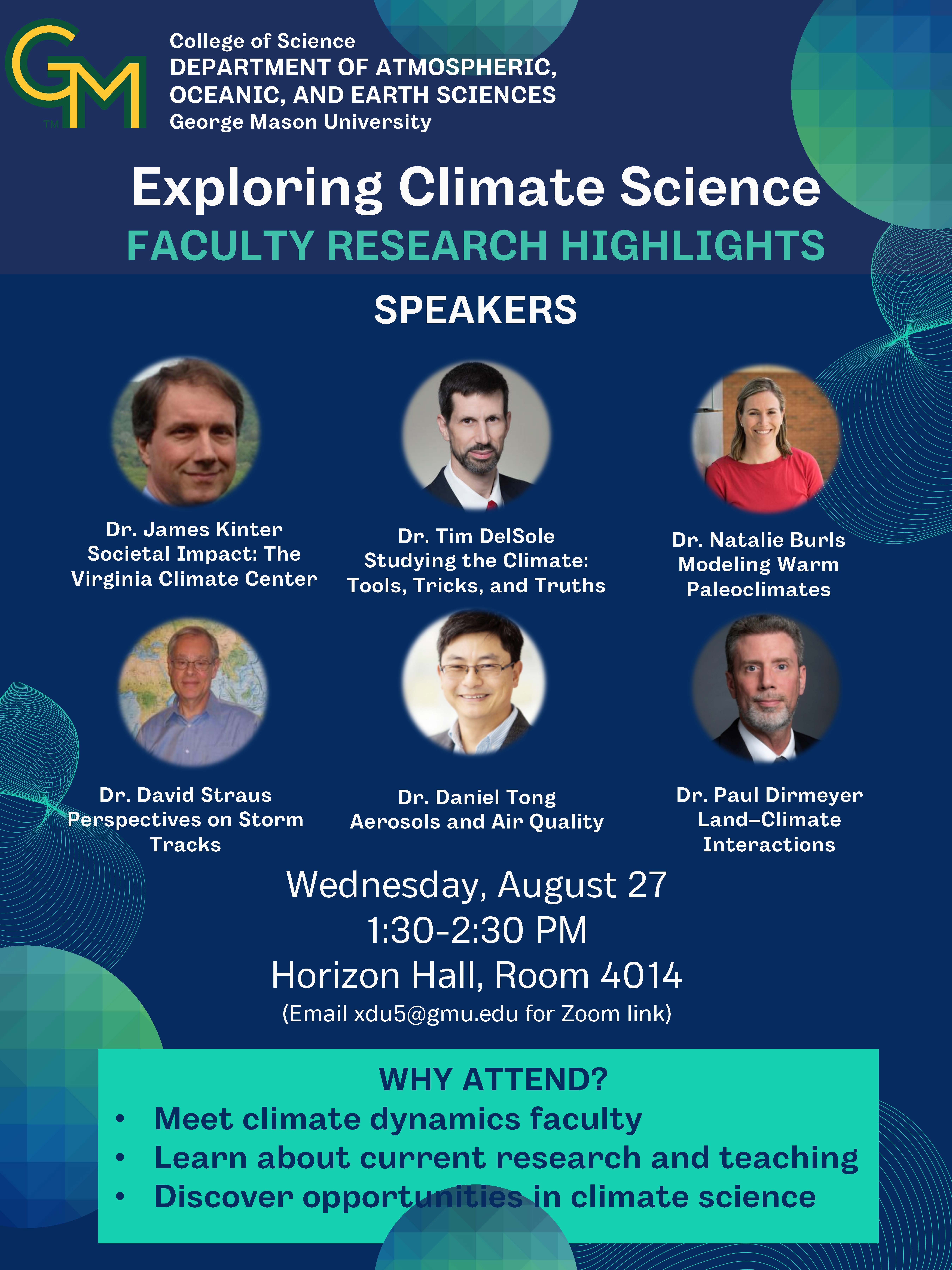
Jim Kinter, Tim DelSole, Natalie Burls, David Straus, Daniel Tong, Paul Dirmeyer, AOES, George Mason University
Title: Exploring Climate Science – Faculty Research Highlights
Time: Wed, 27 Aug, 1:30pm
Location: Horizon Hall, Room 4014 or via Zoom (for Zoom link, email xdu5@gmu.edu)
Host: Xiaojing Du
ABSTRACT: This seminar will feature short presentations by some of our climate dynamics faculty, each highlighting their research focus, recent work, or teaching areas.
- Dr. Jim Kinter – Societal Impact: The Virginia Climate Center
- Dr. Tim DelSole – Studying the Climate: Tools, Tricks, and Truths
- Dr. Natalie Burls – Modeling Warm Paleoclimates: Lessons for the Future
- Dr. David Straus – Perspectives on Storm Tracks
- Dr. Daniel Tong – Aerosols and Air Quality
- Dr. Paul Dirmeyer – Land-Climate Interactions
28 Aug (GEOL) Meet the AOES Geology Faculty
Geoff Gilleaudeau, Jules Goldspiel, Linda Hinnov, Andrew Hoxley, Brittany Hupp, Giuseppina Mattietti, Mark Uhen, Stacey Verardo, AOES, George Mason University
Time: Thu, 28 Aug, 4:30pm
Title: Meet the AOES Geology Faculty
Location: Exploratory 1309 and via Zoom (for link, email lhinnov@gmu.edu)
Host: Linda Hinnov
ABSTRACT: Lightning talks by the AOES geology faculty introducing courses, research programs and student opportunities for the 2025-2026 AY.
- Dr. Geoff Gilleaudeau – Sedimentary Geology and Geochemistry
- Dr. Jules Goldspiel – Planetary Geology
- Dr. Linda Hinnov – Quantitative Stratigraphy
- Dr. Andrew Hoxley – Structural Geology and Geomorphology
- Dr. Brittany Hupp – Paleoceanography and Geochemistry
- Dr. Giuseppina Mattietti – Petrology and Volcanology
- Dr. Mark Uhen – Vertebrate Paleontology
- Dr. Stacey Verardo – Paleoclimatology and Invertebrate Paleontology
3 Sep (CLIM) Are Climate Projections Credible?
Speaker: Timothy DelSole, George Mason University
Title: Are Climate Projections Credible?
Time: Wed, 3 Sep, 1:30pm
Location: Horizon Hall, Room 4014 or via Zoom (for Zoom link, email xdu5@gmu.edu)
Host: Xiaojing Du
ABSTRACT: Climate models disagree on the magnitude of future warming, raising a central question: are climate projections credible? Traditional approaches to deriving observation-constrained projections—such as multi-model weighting, Bayesian frameworks, or emergent constraints—often produce consistent results, yet there are cases when all these methods fail, with no diagnostic to warn users in advance. In this talk, I use Energy Balance Models (EBMs) to construct scenarios in which traditional approaches to constrained projections break down. In particular, reproducing present-day climate statistics is neither necessary nor sufficient for accurate projections. Drawing on insights from these EBM experiments, I propose a new framework for observation-constrained projections that succeeds precisely in situations where conventional methods fail. Unfortunately, the method indicates that CMIP6 simulations do not meet the assumptions necessary for generating credible projections.
4 Sep (GEOL) Jonathan Husson, Stratigraphy and Biogeochemistry
Speaker: Jonathan Husson, University of Victoria, Canada
Title: Constraints on the geologic CaCO3 cycle across Earth history: a data synthesis approach
Time: Thu, 4 Sep, 4:30pm EDT
Location: Exploratory 1309 and via Zoom (for link, email lhinnov@gmu.edu)
Host: Linda Hinnov
ABSTRACT: On geological timescales, the total quantity of carbonate sediment deposited on Earth's surface is determined by chemical weathering fluxes and the input of alkalinity to the global ocean. Where this buried carbonate is sequestered, however, is sensitive to biologic, tectonic and climatic boundary conditions that have changed across Earth history. The locus of carbonate burial is important because (for example) carbonate on the deep sea floor helps to buffer the ocean during transient CO2 pulses and ocean acidification, and also contributes to volcanic CO2 fluxes when subducted. Direct evidence arguing for (or against) carbonate burial in deep ocean basins is not available for time periods older than ~200 million years ago, due to the lack of preserved oceanic crust. Here we use paleogeographic models, the Macrostrat database and geologic maps to describe the age and quantity of carbonate in continental sediments to address this question. Our results indicate that the locus of carbonate deposition has likely changed over time, from primarily oceanic crust over much of the Precambrian to primarily continental crust over much of the Paleozoic, returning in large part to the deep sea after the evolution of pelagic calcifying organisms in the early Mesozoic. Notably, we find evidence to suggest that most, if not all, of the global alkalinity flux could have been trapped on the continental crust during the Paleozoic, leaving the deep sea floor depleted in carbonate sediment. Progressive subduction of carbonate-laden Precambrian sea floor during the Paleozoic, and its replacement by carbonate-depleted sea floor, likely contributed to declining CO2 influx over this era and may have accentuated the effects of environmental perturbations at the end of the Paleozoic.
10 Sep (CLIM) Glenn Wolfe, NASA Carbon Measurement
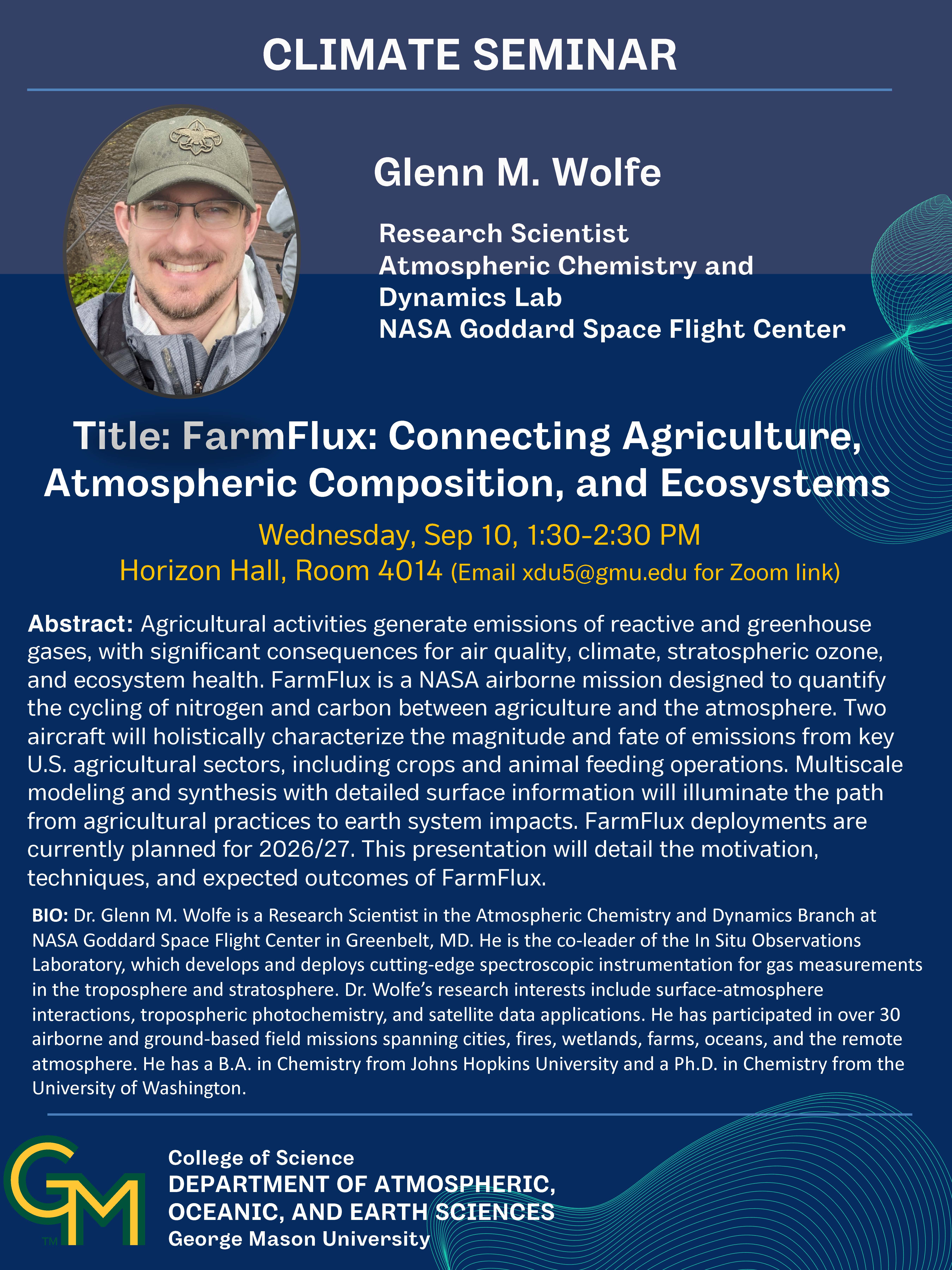
Glenn Wolfe, NASA
Title: FarmFlux: Connecting Agriculture, Atmospheric Composition, and Ecosystems
Time: Wed, 10 Sep, 1:30pm
Location: Horizon Hall, Room 4014 or via Zoom (for Zoom link, email xdu5@gmu.edu)
Host: Daniel Tong
ABSTRACT: Agricultural activities generate emissions of reactive and greenhouse gases, with significant consequences for air quality, climate, stratospheric ozone, and ecosystem health. FarmFlux is a NASA airborne mission designed to quantify the cycling of nitrogen and carbon between agriculture and the atmosphere. Two aircraft will holistically characterize the magnitude and fate of emissions from key U.S. agricultural sectors, including crops and animal feeding operations. Multiscale modeling and synthesis with detailed surface information will illuminate the path from agricultural practices to earth system impacts. FarmFlux deployments are currently planned for 2026/27. This presentation will detail the motivation, techniques, and expected outcomes of FarmFlux.
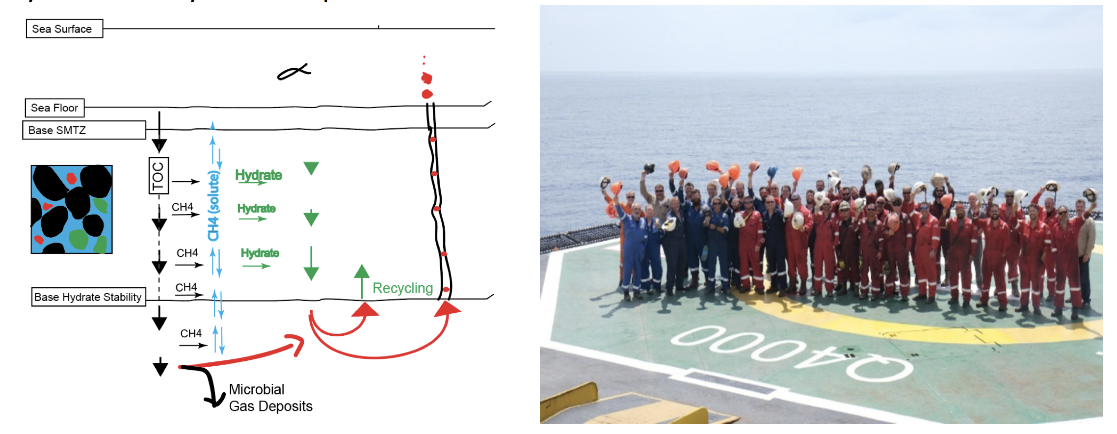
11 Sep (GEOL) Peter Flemings, Methane Hydrates, Basin Analysis
Peter Flemings, UT Austin
Title: Deepwater Methane Hydrates and the Carbon Cycle
Time: Thu, 11 Sep, 4:30pm
Location: Exploratory 1309 and via Zoom (for link, email lhinnov@gmu.edu)
Host: Linda Hinnov
ABSTRACT: 5-22% of Earth’s mobile carbon is sequestered in gas hydrates. In the deep ocean, this hydrate is locked in a layer beneath the seafloor where the temperature is low and pressure high. We drilled, cored, and made downhole measurements to the base of this layer in the deepwater Gulf. We find that the methane concentration increased with depth, reaching saturation (the limit of solubility for methane) at 147 meters. The gas composition is microbial. We interpret that rapid microbial consumption of labile carbon in the shallow section results in shallow hydrate formation. This hydrate is buried with time and recycled at the base of the hydrate stability zone into permeable sandstone reservoirs.
17 Sep (CLIM) Xueke Li, Extreme Weather/Climate
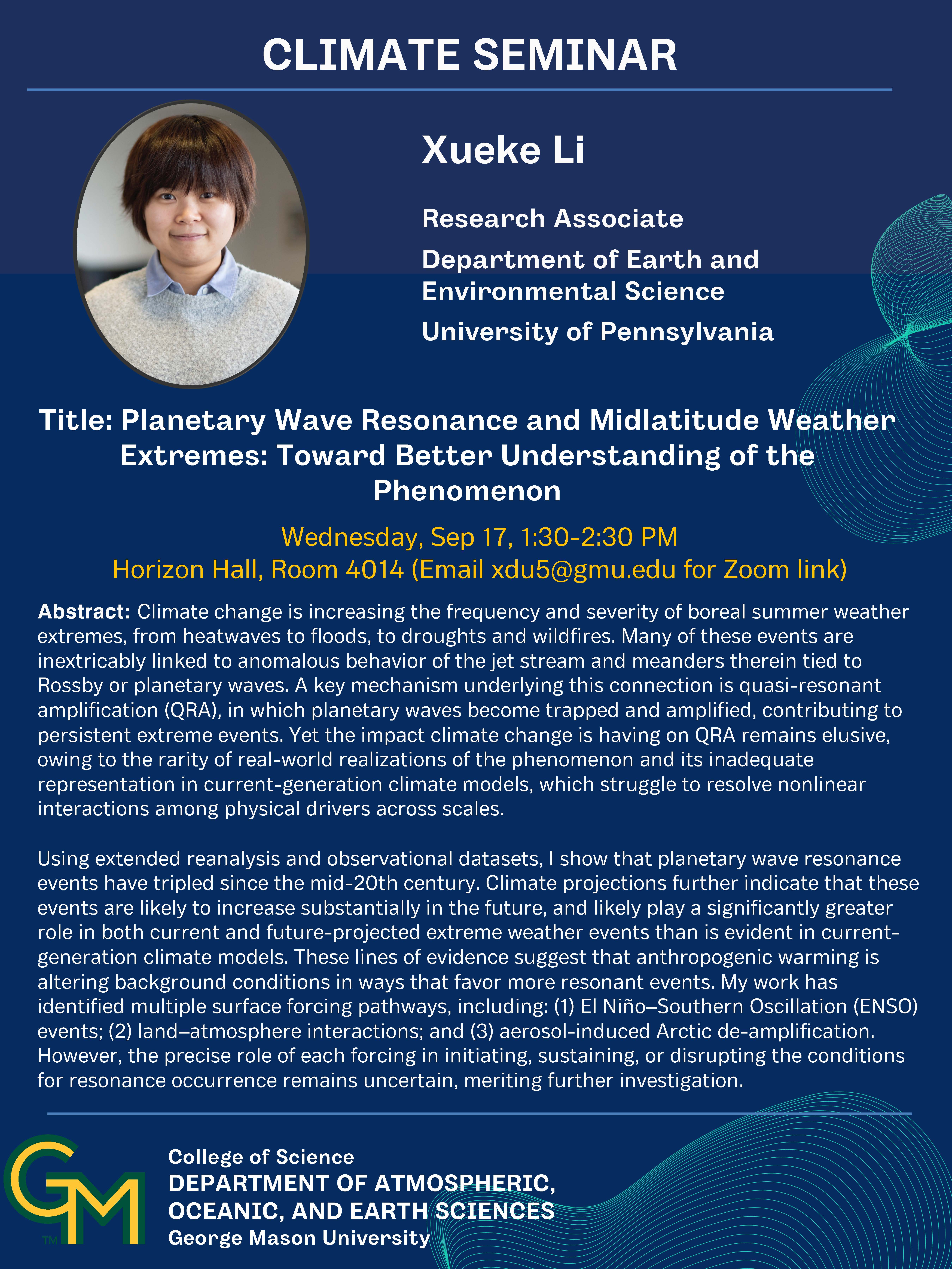
Speaker: Xueke Li, University of Pennsylvania
Title: Planetary Wave Resonance and Midlatitude Weather Extremes: Toward Better Understanding of the Phenomenon
Time: Wed, 17 Sep, 1:30pm
Location: Horizon Hall, Room 4014 or via Zoom (for Zoom link, email xdu5@gmu.edu)
Host: Xiaojing Du
ABSTRACT: Climate change is increasing the frequency and severity of boreal summer weather extremes, from heatwaves to floods, to droughts and wildfires. Many of these events are inextricably linked to anomalous behavior of the jet stream and meanders therein tied to Rossby or planetary waves. A key mechanism underlying this connection is quasi-resonant amplification (QRA), in which planetary waves become trapped and amplified, contributing to persistent extreme events. Yet the impact climate change is having on QRA remains elusive, owing to the rarity of real-world realizations of the phenomenon and its inadequate representation in current-generation climate models, which struggle to resolve nonlinear interactions among physical drivers across scales.
Using extended reanalysis and observational datasets, I show that planetary wave resonance events have tripled since the mid-20th century. Climate projections further indicate that these events are likely to increase substantially in the future, and likely play a significantly greater role in both current and future-projected extreme weather events than is evident in current-generation climate models. These lines of evidence suggest that anthropogenic warming is altering background conditions in ways that favor more resonant events. My work has identified multiple surface forcing pathways, including: (1) El Niño–Southern Oscillation (ENSO) events; (2) land–atmosphere interactions; and (3) aerosol-induced Arctic de-amplification. However, the precise role of each forcing in initiating, sustaining, or disrupting the conditions for resonance occurrence remains uncertain, meriting further investigation.
18 Sep (GEOL) Jonathan Obrist-Farner, Paleolimnology
Jonathan Obrist-Farner, Missouri Science and Technology University
Title: Lessons from the past that inform our future: A sedimentologist perspective on tectonics, climate and paleoenvironmental change
Time: Thu, 18 Sep, 4:30pm
Location: Exploratory 1309 and via Zoom (for link, email lhinnov@gmu.edu)
Host: Linda Hinnov
ABSTRACT: As Earth’s atmosphere warms and human populations grow, more people are becoming vulnerable to both natural and human-induced disasters. This is especially true in Central America, where a rapidly expanding population faces climate extremes and a wide range of geological hazards. In this talk, I will synthesize nine years of sedimentological and paleolimnological research in western Central America that has helped us address some of these challenges. In the first part, I will show how the recent sedimentological record of lakes has been used to reconstruct past tectonic activity along the North American and Caribbean plate boundary. We will examine six lakes situated along this boundary and explore how the catastrophic 1976 Mw 7.5 Motagua earthquake impacted them. By combining documentation of destruction with sedimentary evidence, we were able to understand how the asymmetric distribution of seismic energy during the event influenced not only the lakes but also the broader pattern of destruction. This work provides crucial insight into how lakes respond to recent earthquakes, enabling us to calibrate their records and use them to investigate the paleoseismic history of the region, including how often the boundary ruptures in large earthquakes. The second part of the talk will focus on how our work laid the foundation for the Lake Izabal Basin Research Endeavor (LIBRE) International Continental Scientific Drilling Program. The project aims to establish a seismic observatory along the North American and Caribbean plate boundary and to recover long sediment cores from the deep basin. Analyses of seismicity near the Lake Izabal Basin, combined with industry seismic data, well logs, outcrops, and Holocene sediment cores, have allowed us to reconstruct the basin’s infill history and its tectonic evolution. Outcrop observations and seismic interpretations suggest the basin preserves a sedimentary record spanning several million years. Radiocarbon-dated sediment cores from Lake Izabal, which lies on the basin’s eastern side, provide a first glimpse into this record, revealing evidence of Holocene hydroclimate change, sea-level shifts, and ecosystem dynamics in the northern Neotropics. Future drilling through LIBRE will extend this record back eight million years, offering unprecedented insight into Earth’s history while also improving our ability to assess seismic risk in the region.
24 Sep (CLIM) Alan Robock, Nuclear Winter

Alan Robock, Department of Environmental Sciences, Rutgers University
Title: Global Famine after Nuclear War
Time: Wed, 24 Sep, 1:30pm
Location: Horizon Hall, Room 4014 or via Zoom (for Zoom link, email xdu5@gmu.edu)
Host: Jim Kinter
ABSTRACT: While nuclear weapons make many of us think of horrific immediate destruction, what we don’t consider as often is the profound climate transformation that could turn fertile regions into barren wastelands. The world as we know it could end any day as a result of a nuclear war between the United States and Russia. The fires produced by attacks on cities and industrial areas would generate smoke that would blow around the world, persist for years, and block out sunlight, producing a nuclear winter. Because temperatures would plunge below freezing, crops would die and massive starvation could kill most of humanity. Even a nuclear war between newer nuclear states, such as India and Pakistan, could produce climate change unprecedented in recorded human history and massive disruptions to the world’s food supply. This talk will discuss climate and crop model simulations that support this theory. The theory cannot be tested in the real world, but the fate of the dinosaurs, volcanic eruptions, urban fires during World War II, and forest fires all serve as analogs that support the theory. By highlighting these risks and the ongoing international efforts to prevent such scenarios, this lecture aims to inform and inspire action towards a more secure global future.
25 Sep (GEOL) Advait Jukar, Vertebrate Paleontology
Speaker: Advait Jukar, Florida Museum of Natural History, University of Florida
Title: The Evolution of Local Communities in Deep and Near Time
Time: Thu, 25 Sep, 4:30pm
Location: Exploratory 1309 and via Zoom (for link, email lhinnov@gmu.edu)
Host: Linda Hinnov
ABSTRACT: There is a growing body of literature that suggests that local fossil assemblages, our closest approximation of contemporaneous groups of species, can provide novel insights into the evolution of ecological structures through deep time. I have been exploring the evolution of local communities in the fossil record from a variety of angles. In this lecture, I will present three aspects of my research program: the first which explores the evolution of the local herbivore guild in South Asia over the last 20 million years, the second which explores how the size structure of the local herbivore guild varies from the Mesozoic to the Cenozoic in North America, and lastly, how the recent extinction of megafauna fundamentally changed how mammal communities are structured in the modern, arguing for an extended Anthropocene.
1 Oct (CLIM) Andrew Feldman, Terrestrial Ecology
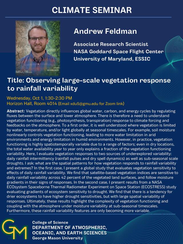
Speaker: Dr. Andrew Feldman, NASA Goddard Space Flight Center, University of Maryland
Title: Observing large-scale vegetation response to rainfall variability
Host: Tahmidul Azom Sany
Time: Wed, 1 Oct, 1:30pm
Location: Horizon Hall, Room 4014 or via Zoom (for Zoom link, email xdu5@gmu.edu)
Abstract: Vegetation directly influences global water, carbon, and energy cycles by regulating fluxes between the surface and lower atmosphere. There is therefore a need to understand vegetation functioning (e.g., photosynthesis, transpiration) response to climate forcing and feedbacks on the atmosphere. To a first order, it is well understood where vegetation is limited by water, temperature, and/or light globally at seasonal timescales. For example, soil moisture nonlinearly controls vegetation functioning, leading to more water limitation in arid environments and energy limitation in humid environments. However, in practice, vegetation functioning is highly spatiotemporally variable due to a range of factors; even in dry locations, the total water availability year to year only explains a fraction of the vegetation functioning variability. Here, I evaluate vegetation responses to two sources of underexplored variability: daily rainfall intermittency (rainfall pulses and dry spell dynamics) as well as sub-seasonal scale droughts. I ask: what are the spatial patterns for how vegetation responds to rainfall variability and extremes? In the first case, I present a global study that evaluates vegetation sensitivity to effects of daily rainfall variability. We find that satellite-based vegetation indices are sensitive to daily rainfall variability across 42 percent of the vegetated land surfaces, and follow moisture gradients in their signs of responses. In the second case, I present results from a NASA ECOsystem Spaceborne Thermal Radiometer Experiment on Space Station (ECOSTRESS) study evaluating gradients of ecosystem sensitivity to drought. We find that there is a tendency for drier ecosystems to have higher drought sensitivities, but with large spatial variability of responses. Ultimately, these results highlight the complexity of vegetation functioning and coupling with the atmosphere under moisture variability at sub-seasonal timescales. Furthermore, these rainfall variability features are only becoming more variable.
Bio: Andrew is an associate research scientist in the Biospheric Sciences Laboratory at NASA Goddard Space Flight Center and research faculty at University of Maryland ESSIC in Maryland, USA. His main goal is to understand how environmental variability and extremes influence global plant function and evaporation, and the consequent global water cycle responses. Drylands, such as in the western U.S., are a large focus of his work. He is currently a member of the NASA ECOSTRESS Science Team and co-leads the scoping for the NASA Adaptation and Response in Drylands (ARID) proposed dryland field campaign. Andrew received his Ph.D. from Massachusetts Institute of Technology in 2021. In 2016, he graduated from Drexel University with B.S. and M.S. degrees in Civil Engineering. Andrew was formerly a NASA Postdoctoral Program Fellow.
2 Oct (GEOL) Burch Fisher, Geomorphology
Speaker: Burch Fisher, University of Maryland Center for Environmental Science
Title: Evidence for orbital pacing of erosion from the southern Central Andes during the Pliocene
Time: Thu, 2 Oct, 4:30pm
Location: Exploratory 1309 and via Zoom (for link, email lhinnov@gmu.edu)
Host: Linda Hinnov
ABSTRACT: It has long been hypothesized that climate can modify both the pattern and magnitude of erosion in orogenic landscapes, thereby controlling orogenic morphology and rates of deformation, as well as potentially modulating global carbon and nutrient cycles through weathering feedbacks. Although conceptually appealing, empirical evidence for a direct climatic control on erosion rate has remained ambiguous owing to prevalent spatial coupling between present-day tectonic, topographic relief, and precipitation maxima, as well as mismatches between timescales of climatic forcing, landscape responses, and erosion-rate proxies. Given these confounding factors, empirical evidence for long-term synchrony between known climate oscillations and sediment fluxes has predominantly relied on numerical modeling and/or the temporal coincidence between large-scale global climate shifts and long-term measurements of sediment volume or erosion-rate proxies. In this talk I will discuss results and caveats from a highly unique field setting that provides compelling evidence for long-term synchrony between cosmogenic radionuclide derived paleo-erosion rates and Milankovitch forcings in the southern Central Andes during the Pliocene.
8 Oct (CLIM) Elizabeth Wallace, Coastal Climate Hazards
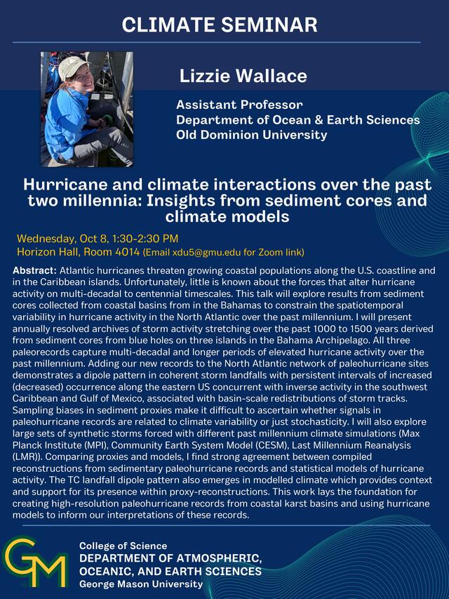
Speaker: Dr. Elizabeth Wallace, Old Dominion University
Title: Hurricane and climate interactions over the past two millennia: Insights from sediment cores and climate models
Host: Xiaojing Du
Time: Wed, 8 Oct, 1:30pm
Location: Horizon Hall, Room 4014 or via Zoom (for Zoom link, email xdu5@gmu.edu)
Abstract: Atlantic hurricanes threaten growing coastal populations along the U.S. coastline and in the Caribbean islands. Unfortunately, little is known about the forces that alter hurricane activity on multi-decadal to centennial timescales. This talk will explore results from sediment cores collected from coastal basins from in the Bahamas to constrain the spatiotemporal variability in hurricane activity in the North Atlantic over the past millennium. I will present annually resolved archives of storm activity stretching over the past 1000 to 1500 years derived from sediment cores from blue holes on three islands in the Bahama Archipelago. All three paleorecords capture multi-decadal and longer periods of elevated hurricane activity over the past millennium. Adding our new records to the North Atlantic network of paleohurricane sites demonstrates a dipole pattern in coherent storm landfalls with persistent intervals of increased (decreased) occurrence along the eastern US concurrent with inverse activity in the southwest Caribbean and Gulf of Mexico, associated with basin-scale redistributions of storm tracks. Sampling biases in sediment proxies make it difficult to ascertain whether signals in paleohurricane records are related to climate variability or just stochasticity. I will also explore large sets of synthetic storms forced with different past millennium climate simulations (Max Planck Institute (MPI), Community Earth System Model (CESM), Last Millennium Reanalysis (LMR)). Comparing proxies and models, I find strong agreement between compiled reconstructions from sedimentary paleohurricane records and statistical models of hurricane activity. The TC landfall dipole pattern also emerges in modelled climate which provides context and support for its presence within proxy-reconstructions. This work lays the foundation for creating high-resolution paleohurricane records from coastal karst basins and using hurricane models to inform our interpretations of these records.
9 Oct (GEOL) Tal Ezer, Oceanography
Speaker: Tal Ezer, Center for Coastal Physical Oceanography, Department of Ocean and Earth Sciences, Old Dominion University
Title: On remote Atlantic Ocean impacts on the coasts of the Mid-Atlantic Bight
Time: Thu, 9 Oct, 4:30pm
Location: Exploratory 1309 and via Zoom (for link, email lhinnov@gmu.edu)
Host: Linda Hinnov
ABSTRACT: Recent studies (see references) indicated significant links between the dynamics of the coasts and bays of the Mid-Atlantic Bight (MAB) and remote impacts from Atlantic Ocean variability. Variations in the North Atlantic Oscillation (NAO), the Atlantic Meridional Overturning Circulation (AMOC) and the Gulf Stream (GS) can affect the regional weather, climate, and sea level along the US East Coast. These connections were examined using observations and numerical models. Studies show for example that the impact of hurricanes on the coast is more complex than previously recognized- in addition to the well-known short-term storm surges, hurricanes that do not make landfall can still disrupt the flow of the GS and cause a post-storm sea level rise and unexpected flooding for weeks after storms disappeared. Analysis of high-frequency radar observations (CODAR) of surface currents in the MAB shows that the dynamics is affected by a combination of local estuarine and coastal factors such as seasonal wind and river discharges, as well as by remote impacts from NAO and the GS that are difficult to predict. A better understanding of the interaction between coastal dynamics and the open ocean will improve predictions of the impacts of climate change on coastal communities, which are already affected by increased flooding due to sea level rise.
References:
https://doi.org/10.1146/annurev-marine-040224-120037 (Ann. Rev. Mar. Sci. 2025)
https://www.frontiersin.org/journals/marine-science/articles/10.3389/fmars.2025.1645286/ (Front. Mar. Sci. 2025)
https://doi.org/10.1007/s10236-024-01605-y (Ocean Dyn. 2024)
https://doi.org/10.1007/s10236-024-01656-1 (Ocean Dyn. 2024)
http://dx.doi.org/10.1007/s10236-022-01536-6 (Ocean Dyn. 2022)
15 Oct (CLIM) Stan Benjamin, Clouds and Radiation
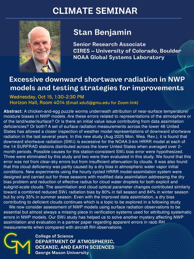
Speaker: Dr. Stan Benjamin, CIRES – University of Colorado, Boulder; NOAA Global Systems Laboratory
Title: Excessive downward shortwave radiation in NWP models and testing strategies for improvements
Host: James Kinter
Time: Wed, 15 Oct, 1:30pm
Location: Horizon Hall, Room 4014 or via Zoom (for Zoom link, email xdu5@gmu.edu)
Abstract: A chicken-and-egg puzzle worms underneath attribution of near-surface temperature/ moisture biases in NWP models. Are these errors related to representations of the atmosphere or of the land/water/surface? Or is there an initial value issue contributing from data assimilation deficiencies? Or both? A set of surface radiation measurements across the lower 48 United States has allowed a closer inspection of weather model representations of downward shortwave radiation in the last several years. In this new study (Aug 2025 Mon. Wea. Rev.), it is found that downward shortwave radiation (SW↓) is excessive for the NOAA 3-km HRRR model at each of the 14 SURFRAD stations distributed across the lower United States when averaged over 2-month periods. Possible causes for this station-consistent SW↓ bias error were hypothesized. Three were eliminated by this study and two were then evaluated in this study. We found that this error was not from clear-sky errors but from insufficient attenuation by clouds. It was also found that this cloud deficiency was partly caused by a dry bias in atmospheric water vapor initial conditions. New experiments using the hourly cycled HRRR model-assimilation system were designed and carried out for three seasons with modified data assimilation addressing the dry bias problem and reduction of effective radius for cloud water droplets for both explicit and subgrid-scale clouds. The assimilation and cloud optical parameter changes contributed similarly toward a combined reduced SW↓ radiation bias by 80% in fall season and 84% in winter season but by only 35% in summer season. Even with the improved data assimilation, a dry bias contributing to deficient clouds continues which is a topic to be explored in a following study.
We now consider assessment of NWP models using surface radiation observations to be essential but almost always a missing piece in verification systems used for attributing systematic errors in NWP models. Our SW↓ study has helped us to solve another mystery affecting NWP assimilation and evaluation in a partner paper regarding apparent errors in raob RH measurements when compared with aircraft RH observations.
16 Oct (GEOL) Scott Wing, Paleobotany
Speaker: Scott Wing, Museum of Natural History, Smithsonian Institution
Title: The response of terrestrial vegetation to sudden global warming 56 million years ago
Time: Thu, 16 Oct, 4:30pm
Location: Exploratory 1309 and via Zoom (for link, email lhinnov@gmu.edu)
Host: Linda Hinnov
ABSTRACT: The Eocene Epoch began with a sudden release of thousands of gigaton of organic carbon that triggered global warming of about 6 degrees C, and other attendant changes in climate, geochemical cycles and ecological systems. This event is called the Paleocene-Eocene Thermal Maximum (PETM). I will show in detail how the PETM affected terrestrial vegetation in the northern Rocky Mountains, briefly discuss effects at higher trophic levels, and end by speculating on what lessons we can draw about future anthropogenic climate change from the PETM.
22 Oct (CLIM) Eojin Kim
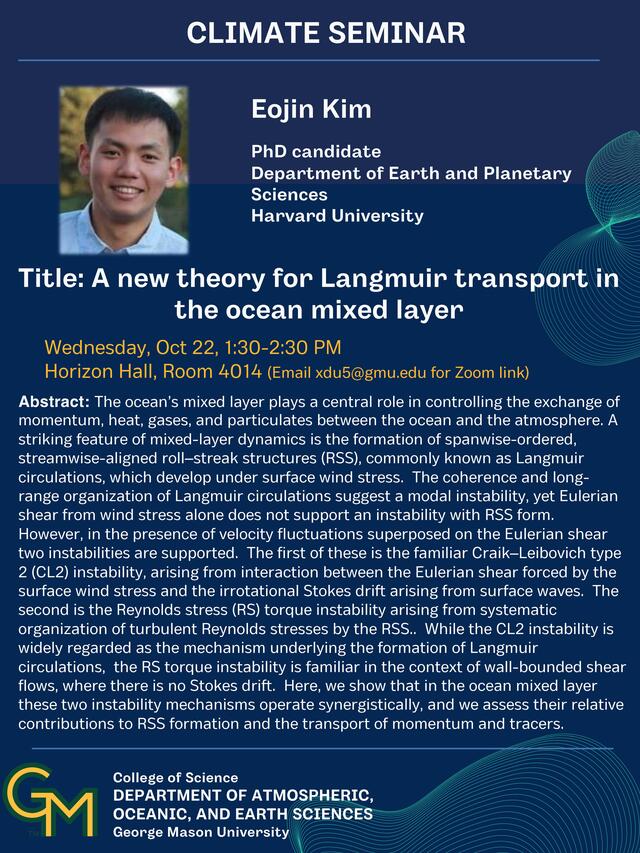
Speaker: Eojin Kim, Harvard University
Title: A new theory for Langmuir transport in the ocean mixed layer
Host: Timothy Delsole
Time: Wednesday, Oct 22, 1:30-2:30 PM
Location: Horizon Hall, Room 4014 (Email xdu5@gmu.edu for Zoom link)
Abstract: The ocean’s mixed layer plays a central role in controlling the exchange of momentum, heat, gases, and particulates between the ocean and the atmosphere. A striking feature of mixed-layer dynamics is the formation of spanwise-ordered, streamwise-aligned roll–streak structures (RSS), commonly known as Langmuir circulations, which develop under surface wind stress. The coherence and long-range organization of Langmuir circulations suggest a modal instability, yet Eulerian shear from wind stress alone does not support an instability with RSS form. However, in the presence of velocity fluctuations superposed on the Eulerian shear two instabilities are supported. The first of these is the familiar Craik–Leibovich type 2 (CL2) instability, arising from interaction between the Eulerian shear forced by the surface wind stress and the irrotational Stokes drift arising from surface waves. The second is the Reynolds stress (RS) torque instability arising from systematic organization of turbulent Reynolds stresses by the RSS.. While the CL2 instability is widely regarded as the mechanism underlying the formation of Langmuir circulations, the RS torque instability is familiar in the context of wall-bounded shear flows, where there is no Stokes drift. Here, we show that in the ocean mixed layer these two instability mechanisms operate synergistically, and we assess their relative contributions to RSS formation and the transport of momentum and tracers.
Bio: Eojin Kim is a PhD candidate in Department of Earth and Planetary Sciences at Harvard University. He received his B.S. in Engineering Science at UC Berkeley in 2019. His major research interests include understanding dynamics of coherent structures in turbulence. In geophysical contexts, those include understanding roll streak structures (RSS) in planetary boundary layers.
23 Oct (GEOL) Val Finlayson, Tectonics, Mantle Processes
Speaker: Val Finlayson, University of Maryland, College Park
Title: Tungsten-182 and Chemical Geodynamics: A case study from the Easter-Salas y Gomez Plume
Time: Thu, 23 Oct, 4:30pm
Location: Exploratory 1309 and via Zoom (for link, email lhinnov@gmu.edu)
Host: Linda Hinnov
ABSTRACT: Recent developments in high-precision 182W/184W analyses have revealed the existence of small variations in the W isotopic composition of some high 3He/4He ocean island basalts, resulting from the decay of the short-lived 182Hf nuclide during early-Earth history. In addition to a correlation with helium isotopes, W isotopic variations display a correlation with anomalous high field strength fractionations in the host mantle source, all distinct features of the so-called “FOZO” (FOcal ZOne) component. As FOZO is implicated in the source mantle of most plumes, the characterization of 182W/184W along hotspot tracks may act in part as a geochemical tracer of the distinct FOZO component, and of mantle dynamics in a manner not previously possible with the “traditional” isotopic tools.
The Easter-Salas y Gomez hotspot track represents one example of mantle plume that has been active for at least 35 Myr. Currently, the plume is interacting with the East Pacific Rise (EPR). Previous work along the younger portion of the track has revealed a dynamic history of variable mantle source and melt production, favoring a model of a HIMU-like or FOZO-like (or, alternatively, both) plume mixing with depleted mantle (DMM) melts closer to the EPR. The isotopic variability captured in this part of the track also corresponds with an increase in melt degree closer to the ridge. This range of melt degrees and compositions provides a natural laboratory to better explore dynamics controlling the expression of isotopic anomalies such as 182W/184W deficits or elevated 3He/4He in plume source mantle.
New data from subaerial Rapa Nui (Easter Island) lavas, as well as a suite of submarine lavas dredged from nearby seamounts, reveal variable 182W/184W and 3He/4He in the hotspot track. Herein, I explore the systematics of these isotope systems compared to Sr-Nd-Pb and bulk compositional data of the lavas, as available, to understand the expression and origin of ancient isotopic signals in modern mantle melts. Extended to other plumes globally, this may have implications for the early history and long-term preservation of Earth's mantle.
29 Oct (CLIM) Gerald Rustic, (Paleo)Tropical Climate Variability
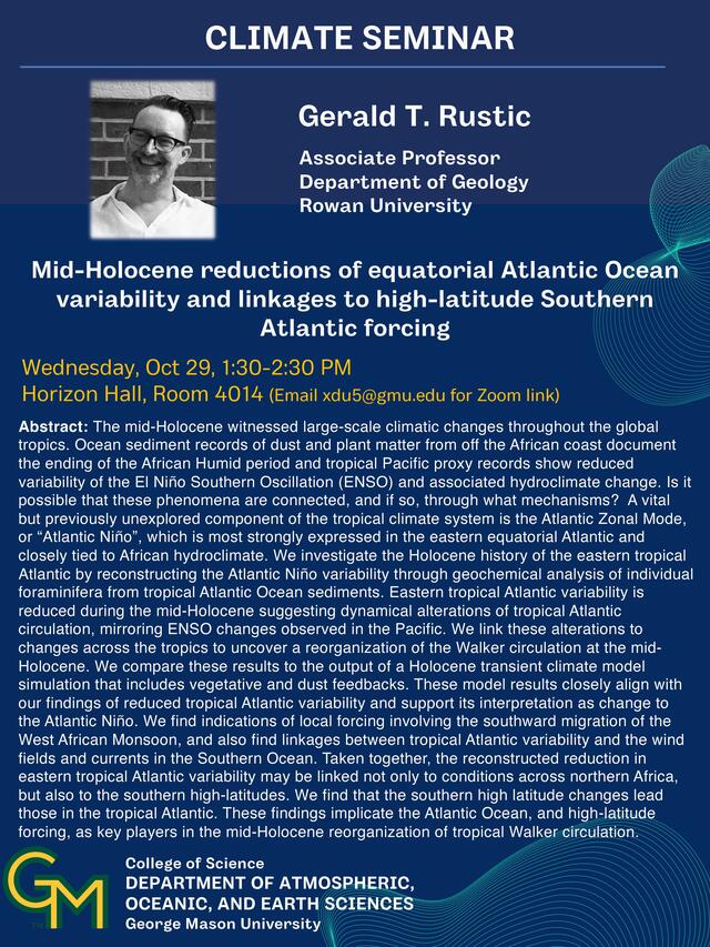
Speaker: Dr. Gerald T. Rustic, Rowan University
Title: Mid-Holocene reductions of equatorial Atlantic Ocean variability and linkages to high-latitude Southern Atlantic forcing
Host: Xiaojing Du
Time: Wednesday, Oct 29, 1:30-2:30 PM
Location: Horizon Hall, Room 4014 (Email xdu5@gmu.edu for Zoom link)
Abstract: The mid-Holocene witnessed large-scale climatic changes throughout the global tropics. Ocean sediment records of dust and plant matter from off the African coast document the ending of the African Humid period and tropical Pacific proxy records show reduced variability of the El Niño Southern Oscillation (ENSO) and associated hydroclimate change. Is it possible that these phenomena are connected, and if so, through what mechanisms? A vital but previously unexplored component of the tropical climate system is the Atlantic Zonal Mode, or “Atlantic Niño”, which is most strongly expressed in the eastern equatorial Atlantic and closely tied to African hydroclimate. We investigate the Holocene history of the eastern tropical Atlantic by reconstructing the Atlantic Niño variability through geochemical analysis of individual foraminifera from tropical Atlantic Ocean sediments. Eastern tropical Atlantic variability is reduced during the mid-Holocene suggesting dynamical alterations of tropical Atlantic circulation, mirroring ENSO changes observed in the Pacific. We link these alterations to changes across the tropics to uncover a reorganization of the Walker circulation at the mid-Holocene. We compare these results to the output of a Holocene transient climate model simulation that includes vegetative and dust feedbacks. These model results closely align with our findings of reduced tropical Atlantic variability and support its interpretation as change to the Atlantic Niño. We find indications of local forcing involving the southward migration of the West African Monsoon, and also find linkages between tropical Atlantic variability and the wind fields and currents in the Southern Ocean. Taken together, the reconstructed reduction in eastern tropical Atlantic variability may be linked not only to conditions across northern Africa, but also to the southern high-latitudes. We find that the southern high latitude changes lead those in the tropical Atlantic. These findings implicate the Atlantic Ocean, and high-latitude forcing, as key players in the mid-Holocene reorganization of tropical Walker circulation.
30 Oct (GEOL) Wendy Kelly, Geohazards, Landslides
Speaker: Wendy Kelly, Division of Geology and Mineral Resources, Virginia Department of Energy
Title: Landslide Mapping in Virginia
Time: Thu, 30 Oct, 4:30pm
Location: Exploratory 1309 and via Zoom (for link, email lhinnov@gmu.edu)
Host: Linda Hinnov
ABSTRACT: A landslide is a type of geologic hazard involving the downslope movement of unconsolidated material. Landslides result from a variety of ground movement processes and produce diagnostic landforms. The primary driving force for a landslide is gravity, but other factors may contribute to the failure of a slope. Landslides in Virginia are usually triggered by heavy rainfall or oversteepening of slopes by stream incision. Human activities that alter natural slopes and water drainages can also greatly increase the likelihood of landslides.
Millions to billions of dollars in property damage, in addition to the potential loss of life can result from landslides, especially debris flows like those experienced during Hurricane Camille in 1969. The Virginia Department of Energy, Geology and Mineral Resources Program is working with the Federal Emergency Management Agency (FEMA) and the Virginia Department of Emergency Management (VDEM) to develop a statewide landslide inventory, in addition to county scale maps highlighting areas that have historically experienced severe storm events. A landslide inventory allows for the development of susceptibility maps identifying areas and infrastructure at greater risk of landslides. These maps can be used by local emergency management, county officials, planning districts, and residents to become better prepared for future storm events.
5 Nov (CLIM) Nkosi Muse, Heat Extremes and People
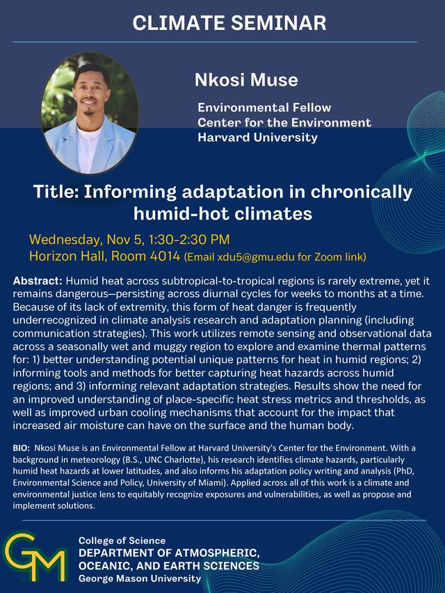
Speaker: Dr. Nkosi Muse, Harvard University
Title: Informing adaptation in chronically humid-hot climates
Host: Luis Ortiz
Time: Wed, 5 Nov, 1:30pm
Location: Horizon Hall, Room 4014 (Email xdu5@gmu.edu for Zoom link)
Abstract: Humid heat across subtropical-to-tropical regions is rarely extreme, yet it remains dangerous—persisting across diurnal cycles for weeks to months at a time. Because of its lack of extremity, this form of heat danger is frequently underrecognized in climate analysis research and adaptation planning (including communication strategies). This work utilizes remote sensing and observational data across a seasonally wet and muggy region to explore and examine thermal patterns for: 1) better understanding potential unique patterns for heat in humid regions; 2) informing tools and methods for better capturing heat hazards across humid regions; and 3) informing relevant adaptation strategies. Results show the need for an improved understanding of place-specific heat stress metrics and thresholds, as well as improved urban cooling mechanisms that account for the impact that increased air moisture can have on the surface and the human body.
Bio: Nkosi Muse is an Environmental Fellow at Harvard University's Center for the Environment. With a background in meteorology (B.S., UNC Charlotte), his research identifies climate hazards, particularly humid heat hazards at lower latitudes, and also informs his adaptation policy writing and analysis (PhD, Environmental Science and Policy, University of Miami). Applied across all of this work is a climate and environmental justice lens to equitably recognize exposures and vulnerabilities, as well as propose and implement solutions.
6 Nov (GEOL) Hamdi Omar, Cyclostratigraphy, Paleoclimatology
Speaker: Hamdi Omar, AOES, George Mason University
Title: Reading Time in Sedimentary Rocks: A Decade of Cyclostratigraphy in Tunisia (Southern Tethys)
Time: Thu, 6 Nov, 4:30pm
Location: Exploratory 1309 and via Zoom (for link, email lhinnov@gmu.edu)
Host: Linda Hinnov
ABSTRACT: Tunisia occupies a key position at the junction between the African craton and the Tethyan realm, recording over 500 million years of geodynamic evolution of stratigraphic basins throughout the Phanerozoic. Its geological architecture is classically subdivided into distinct structural domains (the Tellian domain, the Atlassic chains, and the Saharan Platform), each bearing the imprint of major tectonic and climatic events linked to the opening and closure of the Tethys Ocean, the Alpine orogeny, and the Cenozoic foreland evolution. The Tunisian stratigraphic record offers a nearly continuous archive from the Lower Paleozoic to the Quaternary, encompassing a broad range of depositional environments from continental to deep marine settings. These successions document the interplay of tectonics, eustasy, and climate that shaped North Africa’s geological framework along the southern Tethyan margin.
Unlike Europe, China and the US—where cyclostratigraphic studies have been carried out extensively—studies in North Africa are scarce. Over the past decade (2015 – 2025), we have conducted extensive fieldwork across Tunisia to identify and analyze sedimentary successions that preserve rhythmic bedding patterns amenable to cyclostratigraphic investigation. This work spans multiple regions and time intervals—from Paleozoic source/reservoir rocks to Mesozoic hemipelagic deposits and Cenozoic carbonate platforms—providing a multi-scale view of astronomical forcing in North African stratigraphy. The goal of this long-term effort has been to establish astronomical time scales for key stratigraphic intervals, improve the temporal calibration of regional geological events, and improve the chronostratigraphic framework of Tunisian sedimentary basins.
12 Nov (CLIM) New: Sarker, Finding Internal Variability
New Seminar Listing
Aahelee Sarker, George Mason U
Title:Reevaluating SST Gradient Trends Using ARX-Derived Internal Variability
Time: Wed, 12 Nov, 1:30pm
Location: Horizon Hall, Room 4014 or via Zoom (for Zoom link, email xdu5@gmu.edu)
In this study, we introduce a novel approach for separating forced trends, seasonal cycles, and internal variability in climate time series. The method is based on autoregressive models augmented with external forcing terms to represent the annual cycle and climate change signals, resulting in an ARX model-an autoregressive model with exogenous input. Applying this method to sea surface temperature (SST) data from Coupled Model Intercomparison Project Phase 6 (CMIP6) historical simulations (1958–2014), we find that applying an ARX model to a single ensemble member can effectively capture the externally forced signal traditionally derived from ensemble means, with the ARX model’s forced response and noise variance closely aligning with ensemble-based estimates. This suggests that the ARX model provides a reliable framework for characterizing the internal dynamics of climate variables, based solely on single realization. We apply this model to diagnose the discrepancy between CMIP6 projections of a future weakening in the west-to-east zonal sea surface temperature (SST) gradient and the observed strengthening since the mid-20th century. When applied to observations, the SST gradient trend falls within the range of internal variability, indicating that the observed trend may result from natural variability in the region. Surprisingly, our result also suggests that the observed trend is not inconsistent with model projections once the range of internal variability is accounted for.
13 Nov (GEOL) James Kerr, Paleobiology
Speaker: James Kerr, George Washington University
Title: Biotic Interaction and Extinction: Encrusting and Boring Organisms During the Late Devonian Mass Extinction
Time: Thu, 13 Nov, 4:30pm
Location: Exploratory 1309 and via Zoom (for link, email lhinnov@gmu.edu)
Host: Linda Hinnov
ABSTRACT: Epibiotic and endobiotic organisms are common and diverse in the modern world as well as the fossil record, but their long-term responses to ecological perturbation are not well known. Mass extinctions involve large-scale environmental changes that directly impact many species but secondary effects can be experienced by the remaining organisms. This work seeks to address the questions: 1) What happens to epibiotic and endobiotic organisms during a mass extinction event? and 2) to what degrees are epibiotic and endobiotic commensals differentially affected by changing factors in their abiotic environments and by turnover among their hosts? In order to address these questions, skeletobionts (encrusters and borers of skeletal material) found on brachiopods were sampled from rocks of the Appalachian Basin that stratigraphically straddle a pulse of the Late Devonian Mass Extinction. Abundance, stratigraphic distribution, and settling behavior of the skeletobionts was documented. Multivariable Logistic Regression was then used to compare possible predictors of skeletobiosis including 1) stratigraphic position relative to extinction interval, 2) sculpture of brachiopod hosts, 3) body size of hosts, 4) onshore-offshore location, 5) substrate stability, and 6) extinction fate of hosts. No skeletobiont group was totally lost in the Appalachian basin through this event, but many experienced a drop in abundance. Across the extinction event, the distribution of skeletobionts shifted from being more host-controlled (body size, surface sculpture) to being more strongly controlled by onshore-offshore environmental gradient. Turnover of hosts had no significant effect on skeletobionts through the extinction event.
19 Nov (CLIM) Michela Biasutti, Paleo- and Future Monsoon
Speaker: Michela Biasutti, Columbia University
Title: Rainfall Changes in West Africa: zooming in and out
Host: Meredith Parish
Time: Wed, 19 Nov, 1:30pm
Location: Horizon Hall, Room 4014 (Email xdu5@gmu.edu for Zoom link)
Abstract: The Sahel region, just south of the Sahara desert, has experienced remarkable trends in precipitation over the observational record: from devastating droughts in the 1970s and 1980s, to exceptional increases in extreme rainfall in this century. Yet, putting these trends in perspective is made difficult by the short length and poor coverage of rain gauge data. In this talk, I will take a new look at these trends, using other observational datasets that can complement rainfall records in this region. First, I will introduce new tree-ring-based drought atlases that allow us to zoom out to a multi-century-long history of aridity to give a longer observational context to the 20th-century drought. Second, I will use high-resolution brightness-temperature data to zoom in at the daily scale and reveal how rain-bearing storms are changing in surprising ways in response to steady continental-scale warming and moistening. Observations show us again and again that this is a region uniquely sensitive to local and remote forcings. Renewed observational efforts and next-generation models are both needed to provide guidance for the rainfall trends to come.
Bio: Michela Biasutti (PhD, 2003) studies the dynamics of weather and climate in tropical and subtropical regions; the external forcings and internal mechanisms that have created droughts in the past and will create changes in seasonal and extreme rainfall in the future; and the impacts of climate change on society. At Columbia University since 2004, she currently holds the position of Lamont Research Professor at the Lamont-Doherty Earth Observatory and is a core faculty member in the MA and MS programs in Climate and Society at the Columbia Climate School.
20 Nov (GEOL) Karen Williams, Geophysics
Speaker: Karen Williams, The Virginia Polytechnic Institute and State University
Title: Geodetic and Geodynamic Constraints on Vertical Land Motions in the Chesapeake Bay
Time: Thu, 20 Nov, 4:30pm
Location: Exploratory 1309 and via Zoom (for link, email lhinnov@gmu.edu)
Host: Linda Hinnov
ABSTRACT: The Chesapeake Bay, a region of high financial, historical, and ecological value, experiences the highest rates of relative sea-level rise on the East Coast of the United States. Regional land subsidence enhances sea-level rise, however quantified rates of vertical land motions vary substantially in published solutions and the precise drivers are not well understood. From 2019 to 2023, a collaborative effort led by the USGS was conducted to collect new Global Positioning System (GPS) campaign data throughout the Chesapeake Bay. The new campaign measurements were combined with continuous GPS data from the region covering the same time-period and processed to produce new estimates of vertical velocities and their associated uncertainties. We investigate two proposed long-term, geologic sources of subsidence throughout the Chesapeake Bay: dynamic topography and glacial isostatic adjustment. Dynamic topography is the response of the Earth’s surface due to the convecting mantle. Glacial isostatic adjustment is the response of the Earth’s surface to the growth and decay of global ice sheets. We perform geodynamic modeling to assess the influence of both processes on the region. By isolating the long-term processes contributing to subsidence throughout the Chesapeake Bay, the short-term geological and anthropogenic sources of localized vertical land motions, such as water-use practices, can be better resolved. A comparison with vertical land motions from 50 years ago indicate shifts in the major subsidence regions and changes in subsidence rates. These results have advanced our understanding of the geophysics of the Chesapeake Bay and can be used to help stakeholders in the area make more informed decisions regarding the impacts of regional subsidence. Further, this work highlights the importance of regular monitoring of vertical land motions, which can improve projections of relative sea-level changes and their associated coastal hazards for communities in the Chesapeake Bay region.
3 Dec (CLIM) Allison Michaelis, Extratropical Cyclones
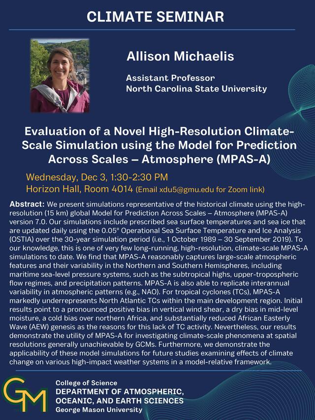
Speaker: Allison Michaelis, North Carolina State University
Title: Evaluation of a Novel High-Resolution Climate-Scale Simulation using the Model for Prediction Across Scales – Atmosphere (MPAS-A)
Host: Austin Reed
Time: Wed, 3 Dec, 1:30pm
Location: Horizon Hall, Room 4014 (Email xdu5@gmu.edu for Zoom link)
Abstract: We present simulations representative of the historical climate using the high-resolution (15 km) global Model for Prediction Across Scales – Atmosphere (MPAS-A) version 7.0. Our simulations include prescribed sea surface temperatures and sea ice that are updated daily using the 0.05° Operational Sea Surface Temperature and Ice Analysis (OSTIA) over the 30-year simulation period (i.e., 1 October 1989 – 30 September 2019). To our knowledge, this is one of very few long-running, high-resolution, climate-scale MPAS-A simulations to date. We find that MPAS-A reasonably captures large-scale atmospheric features and their variability in the Northern and Southern Hemispheres, including maritime sea-level pressure systems, such as the subtropical highs, upper-tropospheric flow regimes, and precipitation patterns. MPAS-A is also able to replicate interannual variability in atmospheric patterns (e.g., NAO). For tropical cyclones (TCs), MPAS-A markedly underrepresents North Atlantic TCs within the main development region. Initial results point to a pronounced positive bias in vertical wind shear, a dry bias in mid-level moisture, a cold bias over northern Africa, and substantially reduced African Easterly Wave (AEW) genesis as the reasons for this lack of TC activity. Nevertheless, our results demonstrate the utility of MPAS-A for investigating climate-scale phenomena at spatial resolutions generally unachievable by GCMs. Furthermore, we demonstrate the applicability of these model simulations for future studies examining effects of climate change on various high-impact weather systems in a model-relative framework.
4 Dec (GEOL) Lydia Staisch, Structural Geology
Speaker: Lydia Staisch, Geology, Minerals, Energy, and Geophysics Science Center, United States Geological Survey
Title: Miocene-Pleistocene river reorganization across the Pacific Northwest and northern Rocky Mountains: clues from detrital zircon provenance and incision markers
Time: Thu, 4 Dec, 4:30pm
Location: Exploratory 1309 and via Zoom (for link, email lhinnov@gmu.edu)
Host: Linda Hinnov
ABSTRACT: For more than a century, researchers have debated the route of the Snake River across the northern Cordillera and Pacific Northwest, including the associated incision history of Hells Canyon. Here, we use detrital zircon U-Pb provenance analysis of Miocene strata upstream and downstream of Hells Canyon constrain the evolution in fluvial pathways over time. Downstream of Hells Canyon, we show that the ~10-6 Ma Clarkston Heights Gravel was dominantly sourced from the nearby Salmon and Clearwater rivers with substantial contribution from drainages that now flow into the western Snake River Plain (wSRP). These same drainages were also contributing to time-equivalent Lake Idaho strata within the wSRP, upstream of Hells Canyon, suggesting Hells Canyon was an active fluvial connection between the wSRP and Columbia Basin before 6 Ma. Results from Lake Idaho strata suggest a two-phased lacustrine history in the wSRP: before ~6.0 Ma, lake strata were derived from local tributaries, suggesting the wSRP was isolated from the modern upper Snake River system. From ~4.3–2.2 Ma, Lake Idaho expanded to include distal tributaries in conjunction with eastward migration of topography from the Yellowstone Hot Spot. Our results challenge the long-held hypothesis of “capture” of the Snake River through Hells Canyon. We infer that the Hells Canyon was a long-established route for outflow of lakes occupying the wSRP, possibly intermittently, during a ~10-2 Ma phase of slow regional incision, followed by rapid incision in Hells Canyon starting about 2 Ma in conjunction with erosion of the topographic barrier impounding Lake Idaho.