
Research
Research
The Department of Geography and Geoinformation Science at George Mason University offers cutting-edge research and education in geography, remote sensing, geoinformatics, and geointelligence. We embrace the complexities of human interactions with natural and urban environments by growing our competence in Geoinformation Science. Located in the Washington DC metropolitan area, the department has strong links with federal agencies and industry, which provides dynamic research opportunities and attracts high quality graduate students.
The department is known for its Geoinformatics research and education, especially on the quantitative aspects. Students will have access to:
- The department and its affiliated centers have a research expenditure of approximate $7M per year, which makes it one of the best funded departments in the United States.
- A 500 node computing and a GPU cluster facility owned by a department center is available to its researchers.
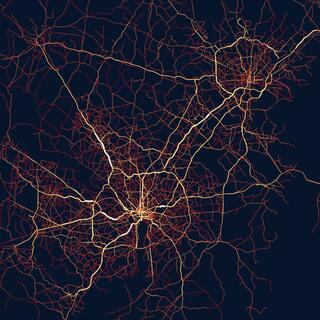
- Cutting-edge topics in deep science inquires and technology advancements at GGS include spatial cloud computing, spatiotemporal big data analytics, deep learning for geospatial sciences, geospatial intelligence, agriculture, natural hazards, crime and network analyses, earth observation, flooding detection, earth modeling, and urban analytics.
Our large Ph.D. program has ~90 students enrollment and has excellent placement in academia (including top GIS programs in the US and internationally), industry (such as Amazon Inc., IBM, Google, Facebook, ESRI), and government (USGS, State, NASA, NOAA). The following is a list of faculty advisors.
- Taylor Anderson - agent based modeling, urban science
- Liping Di – machine learning, remote sensing for agriculture, agro informatics
- Alireza Ermagun - human mobility and travel behavior modeling, social equity and justice in infrastructure planning and delivery, community resilience and sustainable development, automation, electrification, and mobility-as-a-service, transportation geography and network science, data science and urban informatics
- Paul Houser – hydrometeorology, hydro climatology, remote sensing
- Timothy F. Leslie- spatial statistics, urban-economic development, health geography
- Dieter Pfoser – spatiotemporal databases, routing algorithms, trajectory mining, urban analytics
- Edward Oughton - spatial computing, statistical simulation and modeling.
- John Qu – remote sensing, climate and environmental science
- Matt Rice – cartography, geospatial crowdsourcing
- Donglian Sun – remote sensing, flood mapping and prediction
- David Wong – spatial statistics, population geography
- Chaowei (Phil) Yang - spatiotemporal Innovation (Big Data, Cloud Computing, Visualization, AI and Analytics) and Physical Sciences (Climate, Planetary Science, Ocean, and Polar Sciences)
- Ruixin Yang – scientific data mining, climate changes, hurricane modeling
- Konrad Wessels – remote sensing, LiDAR, biomass estimation, terrestrial ecosystem process modelling
Visit our GGS Google Scholar page to read more about our faculty research.
Research Centers | |
Center of Intelligent Spatial Computing for Water/Energy Science (CISC) The joint Center for Intelligent Spatial Computing (CISC) focuses on geospatial information interoperability, high-performance geospatial information processing, geospatial pattern analysis, and spatial GEOSS. Established in 2006, CISC develops research on intelligent spatial computing and collaborates with a number domestic and international agencies, including NASA, NSF, CUE, NPS, EPA, FGDC, Peking University, Wuhan University, Chinese Academy of Sciences, and HeiLongJiang Bureau of Surveying and Mapping. | Chaowei (Phil) Yang, Director cyang3@gmu.edu (703) 993-4742 |
Center for Geospatial Intelligence (GEOINT) The Center for Geospatial Intelligence (CGEOINT) conducts, supports and coordinates research, teaching, technology transfer, and outreach activities in geospatial intelligence. With strong expertise in geoinformatics, ranging from remote sensing and geographic information science to digital image analysis and sensor networks, CGEOINT is uniquely positioned, both academically and geographically, to become an academic leader in the rapidly growing field of Geospatial Intelligence. | Dieter Pfoser, Director |
Center for Earth Observing and Space Research (CEOSR) The Center for Earth Observing and Space Research (CEOSR) provides a focus for cutting-edge research related to satellite platforms, including data acquisition and processing, as well as information extraction and analysis for a variety of application domains such as natural hazards and disaster management, hurricane tracking, and geospatial intelligence. The interdisciplinary center retains strong ties with several government agencies including NASA, NRL and others while also providing needed infrastructure to support research projects falling within its focus areas. | Dr. John Kwiatkowski, Director Arie Croitoru, Associate Director Ryan Wetter, Senior Grants and Finance Analyst |
Multidisciplinary Research
To enhance collaboration and broaden your research network, many of our faculty and students pursue research with one or more of Mason's multidisciplinary research centers.
